Sites and Monuments Record · Ireland
Barrow - ring-barrow
Knocknacrohy, County Limerick, Ireland
The record
- Townland
- Knocknacrohy
- County
- Limerick
- Country
- Ireland
- First-edition OS map
- Not indicated
- Latest-edition OS map
- Not indicated
- Coordinates
- 52.55450, -8.37572
- SMR number
- LI024-245----
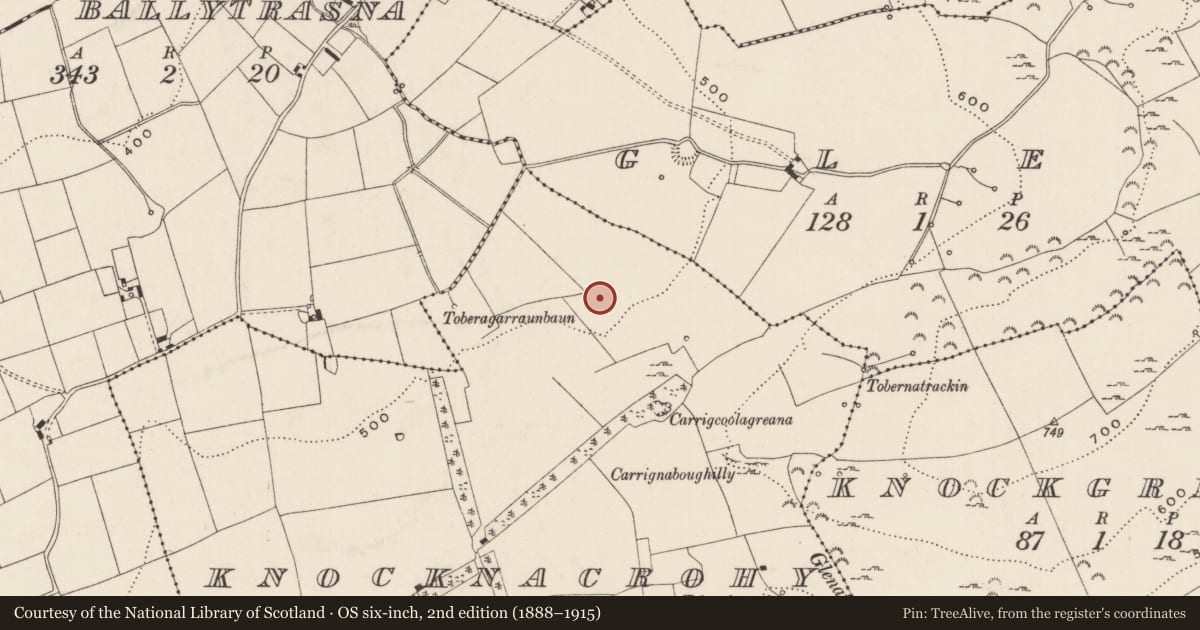
Slide toward Today to fade the historical sheet and see the modern map underneath.
David Rumsey Map Collection, Stanford LibrariesDavid Rumsey Map Collection, Stanford LibrariesDavid Rumsey Map Collection, Stanford LibrariesDavid Rumsey Map Collection, Stanford Libraries
4 historical maps cover this location, the earliest the 1790 map "Composite: Ireland." (David Rumsey Map Collection, Stanford Libraries).
Historical maps covering this location
- 1790 · Composite: Ireland. (David Rumsey Map Collection, Stanford Libraries)
- 1869 · Ireland. (David Rumsey Map Collection, Stanford Libraries)
- 1891 · Ireland 16 (David Rumsey Map Collection, Stanford Libraries)
- 1904 · Sheet 13. (David Rumsey Map Collection, Stanford Libraries)
This record in the National Monuments Service's Historic Environment Viewer ↗
The National Monuments Service's description
In pasture truncated by a drainage ditch / field boundary 90m SW of the townland boundary with Glen (Clanwilliam By.). The barrow is one of a group of four ring-barrows (LI024-161002/003-; LI024-244/245----) in a cemetery 20m apart. The site is not depicted on historic OSi maps, it is visible on OSi orthoimages taken 2005-12 and on the Digital Globe orthoimages taken 2011-2013. Identified during examination of Bruff aerial photographic survey of 1986 (Bruff AP 4/3681) as a ring-barrow. The site is visible with its SW side truncated by a field boundary and drainage ditch, visible on the most recent Google Earth orthoimages taken 18/11/2018. The Placenames Database of Ireland records that Knocknacrohy is derived from the Irish Cnoc na Croiche or Hill of the Gallows (www.logainm.ie). The placename may preserve a folk memory to burial on the hill relating to the proliferation of Bronze Age funerary monuments or ring-barrows on and around it.
See attached Bruff survey image showing the site labelled Bruff 245 and Google Earth orthoimage
Compiled by: Edmond O’Donovan
Date of upload: 18 September 2020
Nearby in the register
- Barrow - ring-barrowunder 1 mi
- Barrow - ring-barrowunder 1 mi
- Barrow - ring-barrowunder 1 mi
- Barrow - ring-barrowunder 1 mi
Other entries of the same register within about three miles of this one, by straight line.