Sites and Monuments Record · Ireland
Barrow - ring-barrow
Knockballyfookeen, County Limerick, Ireland
The record
- Townland
- Knockballyfookeen
- County
- Limerick
- Country
- Ireland
- First-edition OS map
- Not indicated
- Latest-edition OS map
- Not indicated
- Coordinates
- 52.55195, -8.31713
- SMR number
- LI024-053002-
Slide toward Today to fade the historical sheet and see the modern map underneath.
David Rumsey Map Collection, Stanford LibrariesDavid Rumsey Map Collection, Stanford LibrariesDavid Rumsey Map Collection, Stanford LibrariesDavid Rumsey Map Collection, Stanford Libraries
4 historical maps cover this location, the earliest the 1790 map "Composite: Ireland." (David Rumsey Map Collection, Stanford Libraries).
Historical maps covering this location
- 1790 · Composite: Ireland. (David Rumsey Map Collection, Stanford Libraries)
- 1869 · Ireland. (David Rumsey Map Collection, Stanford Libraries)
- 1891 · Ireland 16 (David Rumsey Map Collection, Stanford Libraries)
- 1904 · Sheet 13. (David Rumsey Map Collection, Stanford Libraries)
This record in the National Monuments Service's Historic Environment Viewer ↗
The National Monuments Service's description
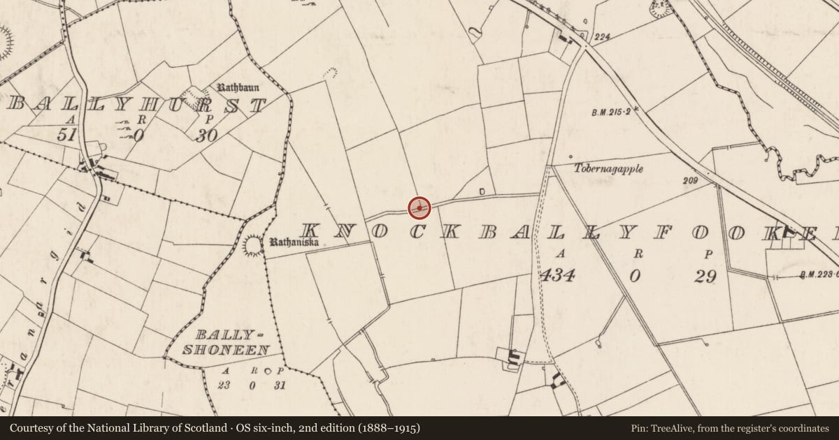
In wet, level pasture, with excellent views of Knockseefin/Pallashill to WNW. Not depicted on OS historic mapping (O'Dwyer 1964, 96-8). Surveyed by the ASI in 2008 and described as a low profile, circular-shaped area (4.6m N-S; 4.1m E-W) defined by an inner fosse (Wth 2.05-2.75m; D 0.14m) well preserved from WSW-W-N-E-S-SSW and external bank (int. H 0.14m; ext. H 0.2-0.23m; Wth 2.5-2.6m) best preserved from NE-E-S-W-NW, merges with a raised area adjoining the exterior from NW-N-NE. A linear mound (Wth 3.5m; H 0.2m) running NNW-SSE lies c. 5.5m to W. A barrow (LI024-053001-) and a possible barrow (LI024-053003-) lie c. 50m and c. 80m to SW and SE respectively. A high concentration of barrows are located within a 300m radius of this monument. Monument is not clearly visible on Digital Globe orthophotos taken 2011-13 and on Google Earth orthoimages taken 28/06/2018.
See attached plan and cross-sections surveyed and drawn by the ASI.
Compiled by: Alison McQueen and Vera Rahilly
Date of upload: 15 July 2020
References
O'Dwyer, M. 1964 A Survey of the earthworks of the district of Old Pallasgrean (concluded). North Munster Antiquarian Journal 9, 94-8.
Nearby in the register
- Enclosureunder 1 mi
- Barrow - unclassifiedunder 1 mi
- Barrow - ring-barrowunder 1 mi
- Barrow - ring-barrowunder 1 mi
Other entries of the same register within about three miles of this one, by straight line.