Sites and Monuments Record · Ireland
Graveyard
Caherelly West, County Limerick, Ireland
The record
- Townland
- Caherelly West
- County
- Limerick
- Country
- Ireland
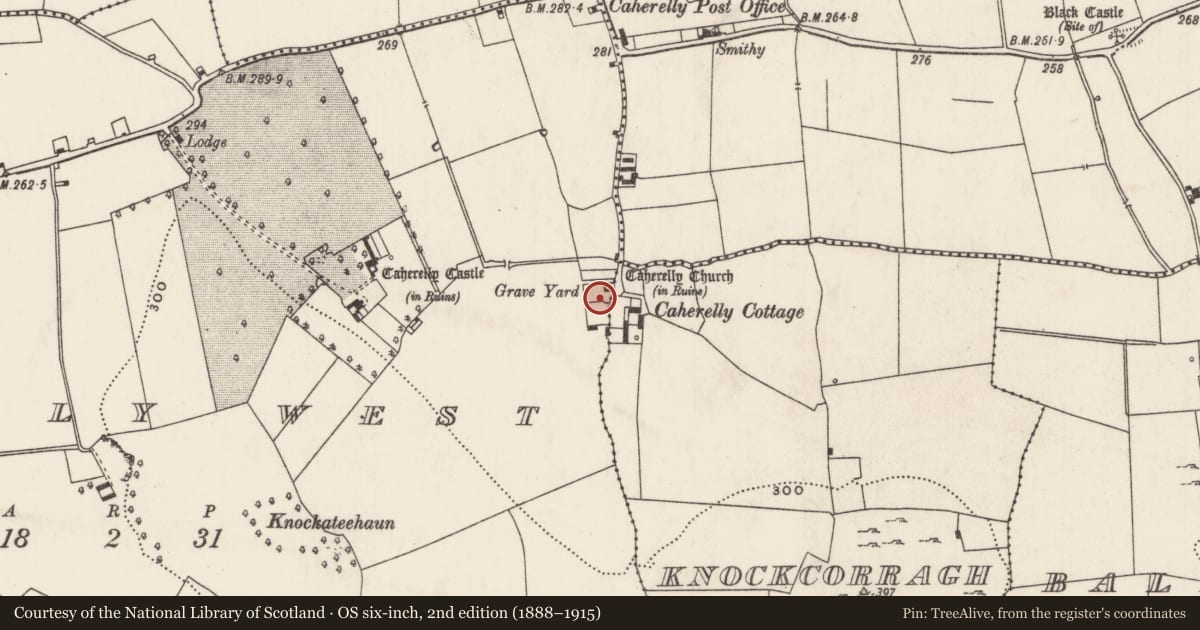
- First-edition OS map
- Grave Yard
- Latest-edition OS map
- Grave Yard (1928)
- Coordinates
- 52.54482, -8.49933
- SMR number
- LI023-085002-
Slide toward Today to fade the historical sheet and see the modern map underneath.
David Rumsey Map Collection, Stanford LibrariesDavid Rumsey Map Collection, Stanford LibrariesDavid Rumsey Map Collection, Stanford LibrariesDavid Rumsey Map Collection, Stanford Libraries
4 historical maps cover this location, the earliest the 1790 map "Composite: Ireland." (David Rumsey Map Collection, Stanford Libraries).
Historical maps covering this location
- 1790 · Composite: Ireland. (David Rumsey Map Collection, Stanford Libraries)
- 1869 · Ireland. (David Rumsey Map Collection, Stanford Libraries)
- 1891 · Ireland 16 (David Rumsey Map Collection, Stanford Libraries)
- 1904 · Sheet 13. (David Rumsey Map Collection, Stanford Libraries)
This record in the National Monuments Service's Historic Environment Viewer ↗
The National Monuments Service's description
Situated on low rise of ground with chancel ruins (LI023-085001-) in NE corner and Caherelly Castle (LI023-083----) 300m to W. Sub-rectangular shaped area (dims. 23.7m N-S; 35.8m E-W) defined by rubble stone wall (T 0.5m; int. H 1.0m; ext. H 0.95m) of post-1700 date. Entrance (Wth 2m) in centre of E-wall is badly damaged and removed to N-side. Small gabled mortuary building (5.5m N-S; 6m E-W) of post-1700 date in SE corner pre-dates graveyard wall. 19th century vaulted tomb of the Wilkinson family occupies NW quadrant. Nineteenth and twentieth century gravestones evenly distributed around graveyard; earliest is 1795 (Ryan) in S-side. Recent interments 1985 (Hayes), 2003 and 2005 (McElligott) in S-side. New graveyard adjacent to S in use since mid-1990's. Architectural fragments of church scattered throughout the graveyard, impossible to make out outline of nave of the church due to the concentration of post-1700 memorials in W quadrant.
Compiled by: Alison McQueen & Vera Rahilly
Revised by: Caimin O'Brien
Date of revised upload: 28 September 2018
Nearby in the register
- Churchunder 1 mi
- Barrow - ring-barrowunder 1 mi
- Castle - tower houseunder 1 mi
- Bawnunder 1 mi
Other entries of the same register within about three miles of this one, by straight line.