Sites and Monuments Record · Ireland
Standing stone
Friarstown (Clanwilliam By., Ballybricken ED), County Limerick, Ireland
The record
- Townland
- Friarstown (Clanwilliam By., Ballybricken ED)
- County
- Limerick
- Country
- Ireland
- First-edition OS map
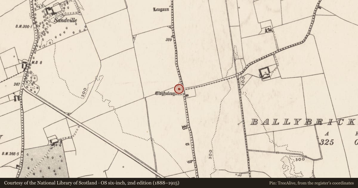
- Cloghaleagaun
- Latest-edition OS map
- Cloghaleagaun (1928)
- Coordinates
- 52.56248, -8.52909
- SMR number
- LI023-033----
Slide toward Today to fade the historical sheet and see the modern map underneath.
David Rumsey Map Collection, Stanford LibrariesDavid Rumsey Map Collection, Stanford LibrariesDavid Rumsey Map Collection, Stanford LibrariesDavid Rumsey Map Collection, Stanford Libraries
4 historical maps cover this location, the earliest the 1790 map "Composite: Ireland." (David Rumsey Map Collection, Stanford Libraries).
Historical maps covering this location
- 1790 · Composite: Ireland. (David Rumsey Map Collection, Stanford Libraries)
- 1869 · Ireland. (David Rumsey Map Collection, Stanford Libraries)
- 1891 · Ireland 16 (David Rumsey Map Collection, Stanford Libraries)
- 1904 · Sheet 13. (David Rumsey Map Collection, Stanford Libraries)
This record in the National Monuments Service's Historic Environment Viewer ↗
The National Monuments Service's description
Roadside, adjacent to concrete-block wall. No visible surface trace of stone named 'Cloghleagaun' on 1928 OS 6-inch map. Described in 1840 as 'a stone called Cloch a Líagáin which measures five feet [1.5m] in height and three feet [0.9m] in diameter, stands erect in a green field in (near) the centre of the townland of Friarstown and a few yards to the west of Ahanvocky [Ahavackig], Aith an Bhacaigh' (OSL Caherelly Parish, 101). Recorded in 1916 as lying 'prostrate' beside an 'old road' (LI023-035----) called 'Boherliagan' (Lynch 1916-19, 11).
Compiled by: Denis Power
Revised by: Caimin O'Brien
Date of revised upload: 16 January 2019
References
OSL - Ordnance Survey Letters. Letters written by members of the Ordnance Survey's 'Topographical Department' (T. O'Conor, A. O'Curry, E. Curry, J. O'Donovan and P. O'Keeffe) sent to headquarters from the field (1834-41). MSS in Royal Irish Academy.
Barry, J. G. 1916-19 Dysert Laurence Parish. Journal of the North Munster Antiquaries Society 4, 6-15.
Nearby in the register
- Road - road/trackwayunder 1 mi
- Standing stoneunder 1 mi
- Standing stoneunder 1 mi
- Enclosureunder 1 mi
Other entries of the same register within about three miles of this one, by straight line.