Sites and Monuments Record · Ireland
Well
Ballyea (Smallcounty By.), County Limerick, Ireland
The record
- Townland
- Ballyea (Smallcounty By.)
- County
- Limerick
- Country
- Ireland
- First-edition OS map
- Indicated
- Latest-edition OS map
- Outlined
- Coordinates
- 52.53335, -8.59596
- SMR number
- LI022-170----
Slide toward Today to fade the historical sheet and see the modern map underneath.
David Rumsey Map Collection, Stanford LibrariesDavid Rumsey Map Collection, Stanford LibrariesDavid Rumsey Map Collection, Stanford LibrariesDavid Rumsey Map Collection, Stanford Libraries
4 historical maps cover this location, the earliest the 1790 map "Composite: Ireland." (David Rumsey Map Collection, Stanford Libraries).
Historical maps covering this location
- 1790 · Composite: Ireland. (David Rumsey Map Collection, Stanford Libraries)
- 1869 · Ireland. (David Rumsey Map Collection, Stanford Libraries)
- 1891 · Ireland 16 (David Rumsey Map Collection, Stanford Libraries)
- 1904 · Sheet 13. (David Rumsey Map Collection, Stanford Libraries)
This record in the National Monuments Service's Historic Environment Viewer ↗
The National Monuments Service's description
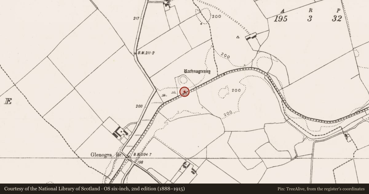
Described in 1840 as following; 'There are five forts in Ballyea Townland, one of which is called Rath na Gréine (LI022-139----), which signifies the Rath of the Sun. Here is a spring well called Tobar Rath na Gréine, that is the Well of the Rath' (OSL, Parish of Fedamore).
Site of well described in 1943 as following; 'O'Donovan mentions a well called Tobar Ratha na Gréine, which, he says, stood beside a fort called Rath na Gréine. The fort exists, but the well has disappeared' (O'Kelly 1942-3, 222).
Well depicted on 25-inch OS map 30m S of ringfort (LI022-139----) known as 'Rath na Gréine' and immediately N of the Camoge River is probably the site of the well called 'Tobar Ratha na Gréine'.
Compiled by: Caimin O'Brien
Date of upload: 28 February 2020
References
OSL - Ordnance Survey Letters. Letters written by members of the Ordnance Survey's 'Topographical Department' (T. O'Conor, A. O'Curry, E. Curry, J. O'Donovan and P. O'Keeffe) sent to headquarters from the field (1834-41). MSS in Royal Irish Academy.
O'Kelly, M.J. 1942-3 A survey of the antiquities in the barony of Small County, Co. Limerick. North Munster Antiquarian Journal 3, 75-97, 169-84, 222-46.
Nearby in the register
- Ringfort - rathunder 1 mi
- Field systemunder 1 mi
- Fulacht fiaunder 1 mi
- Bridgeunder 1 mi
Other entries of the same register within about three miles of this one, by straight line.