Sites and Monuments Record · Ireland
Ritual site - holy well
Gortavalla East, County Limerick, Ireland
The record
- Townland
- Gortavalla East
- County
- Limerick
- Country
- Ireland
- First-edition OS map
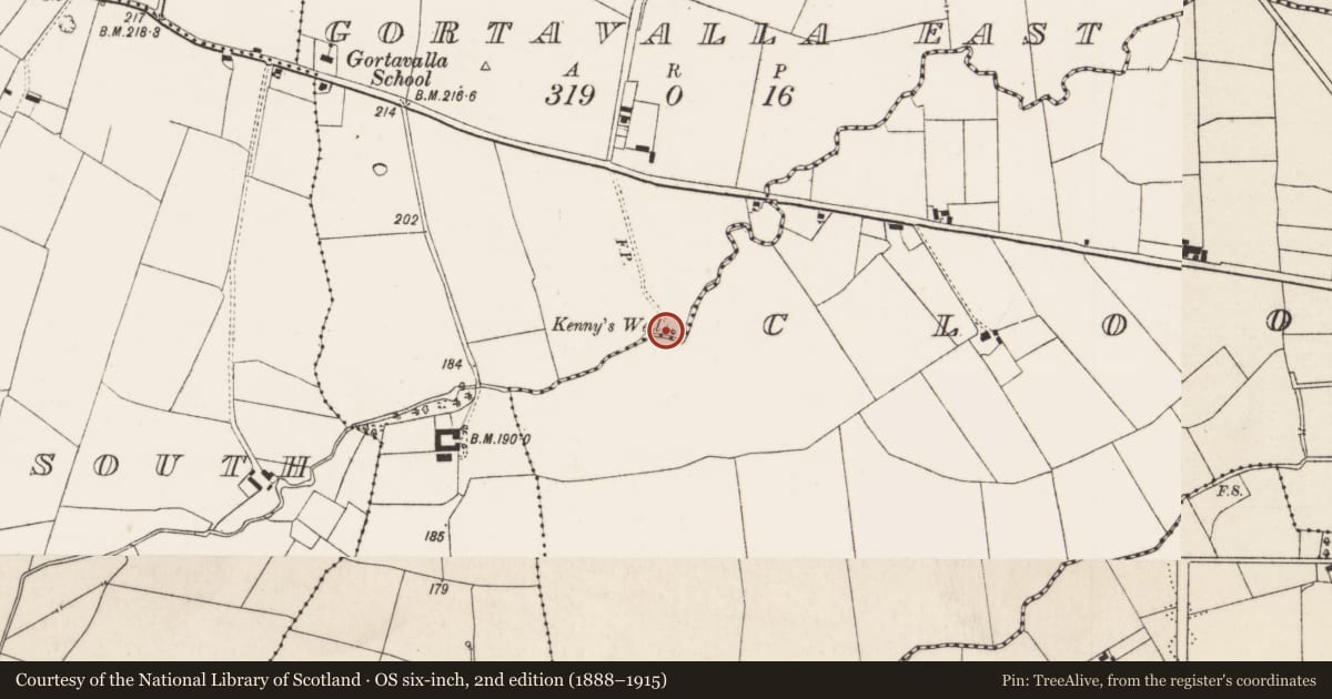
- Kennys Well
- Latest-edition OS map
- Kennys Well (1927)
- Coordinates
- 52.59021, -8.27639
- SMR number
- LI015-039----
Slide toward Today to fade the historical sheet and see the modern map underneath.
David Rumsey Map Collection, Stanford LibrariesDavid Rumsey Map Collection, Stanford LibrariesDavid Rumsey Map Collection, Stanford LibrariesDavid Rumsey Map Collection, Stanford Libraries
4 historical maps cover this location, the earliest the 1790 map "Composite: Ireland." (David Rumsey Map Collection, Stanford Libraries).
Historical maps covering this location
- 1790 · Composite: Ireland. (David Rumsey Map Collection, Stanford Libraries)
- 1869 · Ireland. (David Rumsey Map Collection, Stanford Libraries)
- 1891 · Ireland 16 (David Rumsey Map Collection, Stanford Libraries)
- 1904 · Sheet 13. (David Rumsey Map Collection, Stanford Libraries)
This record in the National Monuments Service's Historic Environment Viewer ↗
The National Monuments Service's description
Situated immediately E of a kink in a stream, in poorly drained pasture. Indicated on the 1927 OS 6-inch map as 'Kenny's Well'. Described by Ó Danachair (1955) as 'a clear spring well about three feet in diameter…the water cured many ailments. Locally called 'Saint Kenny's Well', reputed to be St Cainneach of Kilkenny. There is a legend that the well moved when an infant was washed in it'. The site is now covered by overgrowth but there appears to be a circle or square of rocks around the spring (Wth c 0.5m). The well no longer seems to be in holy use.
See attached photos taken in 1954 by Caoimhín Ó Danachair, courtesy of and © National Folklore Collection, UCD. The Photographic Collection, F025.21.00288 accessible online at www.duchas.ie/en/cbeg/24544 and F025.21.00287 accessible online at www.duchas.ie/en/cbeg/17028.
Compiled by: Denis Power
Revised by: Caimin O'Brien
Date of revised upload: 1 October 2020
References
Ó Danachair, C. 1955 The Holy Wells of County Limerick Journal of the Royal Society of Antiquaries of Ireland 85, 193-217
Nearby in the register
- Barrow - ring-barrowunder 1 mi
- Barrow - ring-barrowunder 1 mi
- Barrow - ring-barrowunder 1 mi
- Earthworkunder 1 mi
Other entries of the same register within about three miles of this one, by straight line.