Sites and Monuments Record · Ireland
Excavation - miscellaneous
Skehacreggaun, County Limerick, Ireland
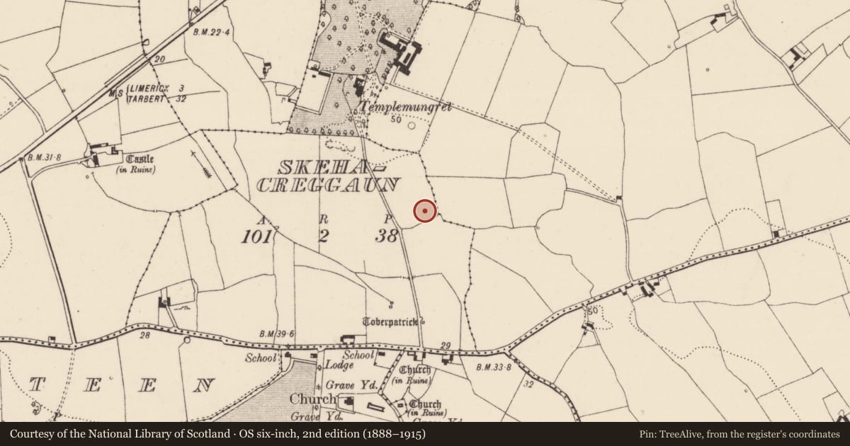
The record
- Townland
- Skehacreggaun
- County
- Limerick
- Country
- Ireland
- Latest-edition OS map
- Not shown.
- Coordinates
- 52.63764, -8.67407
- SMR number
- LI013-226----
Slide toward Today to fade the historical sheet and see the modern map underneath.
David Rumsey Map Collection, Stanford LibrariesDavid Rumsey Map Collection, Stanford LibrariesDavid Rumsey Map Collection, Stanford LibrariesDavid Rumsey Map Collection, Stanford Libraries
4 historical maps cover this location, the earliest the 1790 map "Composite: Ireland." (David Rumsey Map Collection, Stanford Libraries).
Historical maps covering this location
- 1790 · Composite: Ireland. (David Rumsey Map Collection, Stanford Libraries)
- 1869 · Ireland. (David Rumsey Map Collection, Stanford Libraries)
- 1891 · Ireland 16 (David Rumsey Map Collection, Stanford Libraries)
- 1904 · Sheet 13. (David Rumsey Map Collection, Stanford Libraries)
This record in the National Monuments Service's Historic Environment Viewer ↗
The National Monuments Service's description
A small pit identified by J. Kiely during archaeological testing prior to the construction of a housing estate carried out under Licence No. 04E0414 (Kiely 2004). The remains of a corn drying kiln (LI013-225----) c. 20m to the NW and a holy well (LI013-009006 ----) c. 215m to the S were also excavated. The pit was revealed in Field 2, and was located ‘13m from the S end of trench 6’ and the results were summarised as following; ‘An isolated circular pit was recorded c. 25m south of the kiln, measuring 0.3m in diameter, with a maximum depth of 0.15m. A chert scraper was included in the fill’ (www.excavations.ie 2004:No. 1030, Kiley 2007, 248)
Compiled by: Fiona Rooney
Date of upload: 30 June 2020
References
Kiely, J. 2004 Archaeological Test Excavation Report, Skehacreggaun, Mungret, Co. Limerick. Unpublished report (Licence No. 04E0414) submitted by Eachtra Archaeological Projects on behalf of Shabrand Development Ltd. to the National Monuments Service, Dúchas.
Kiely, J. 2007 Skehacreggaun, Mungret: Prehistoric Pit. In I. Bennett (Ed.) Excavations 2004: summary accounts of archaeological excavations in Ireland, 248, No. 1030. Bray. Wordwell.
Nearby in the register
- Kiln - corn-dryingunder 1 mi
- Enclosureunder 1 mi
- Excavation - miscellaneousunder 1 mi
- Souterrainunder 1 mi
Other entries of the same register within about three miles of this one, by straight line.