Sites and Monuments Record · Ireland
Bawn
Lickadoon, County Limerick, Ireland
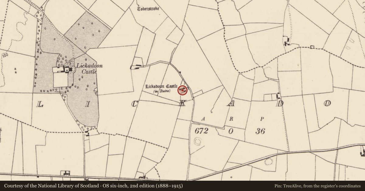
The record
- Townland
- Lickadoon
- County
- Limerick
- Country
- Ireland
- First-edition OS map
- Not indicated
- Latest-edition OS map
- Not indicated
- Coordinates
- 52.60566, -8.58837
- SMR number
- LI013-104001-
Slide toward Today to fade the historical sheet and see the modern map underneath.
David Rumsey Map Collection, Stanford LibrariesDavid Rumsey Map Collection, Stanford LibrariesDavid Rumsey Map Collection, Stanford LibrariesDavid Rumsey Map Collection, Stanford Libraries
4 historical maps cover this location, the earliest the 1790 map "Composite: Ireland." (David Rumsey Map Collection, Stanford Libraries).
Historical maps covering this location
- 1790 · Composite: Ireland. (David Rumsey Map Collection, Stanford Libraries)
- 1869 · Ireland. (David Rumsey Map Collection, Stanford Libraries)
- 1891 · Ireland 16 (David Rumsey Map Collection, Stanford Libraries)
- 1904 · Sheet 13. (David Rumsey Map Collection, Stanford Libraries)
This record in the National Monuments Service's Historic Environment Viewer ↗
The National Monuments Service's description
Westropp (1906-07, 88) recorded the following details about Lickadoon Castle (LI013-104----) and bawn; '1655 The C[astle]. bawne, and twelve cabins held by Jordan Roche (C.S., xxix., p. 19) granted to Duke of York, and in 1703 sold to Dr. T. Smith, Bishop of Limerick.
Fabric - A peel tower, 70 feet [21.3m] high, 15½ feet [4.7m] by 7½ feet [2.3m] inside; walls, 8 feet 10 inches [2.7m] thick; the spiral stair in the eastern section, with the usual large gables and slit windows (O.S.L., 8, p. 151)'. The present farmyard boundary wall may be the remains of the bawn wall or may follow the line of the original bawn wall of Lickadoon Castle.
Compiled by: Caimin O'Brien
Date of upload: 26 November 2020
Nearby in the register
- Castle - tower houseunder 1 mi
- Mill - unclassifiedunder 1 mi
- Ringfort - rathunder 1 mi
- Enclosureunder 1 mi
Other entries of the same register within about three miles of this one, by straight line.