Sites and Monuments Record · Ireland
Ritual site - holy well
Stonehall, County Limerick, Ireland
The record
- Townland
- Stonehall
- County
- Limerick
- Country
- Ireland
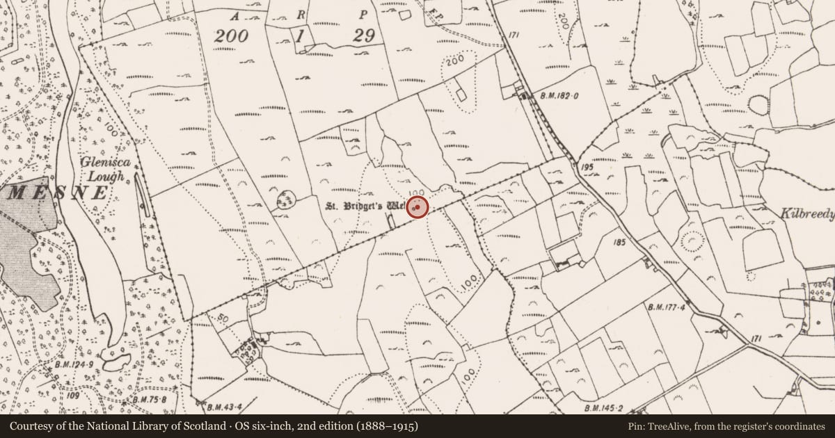
- First-edition OS map
- St. Bridgets Well
- Latest-edition OS map
- St. Bridgets Well (1923)
- Coordinates
- 52.60304, -8.86016
- SMR number
- LI011-077----
Slide toward Today to fade the historical sheet and see the modern map underneath.
David Rumsey Map Collection, Stanford LibrariesDavid Rumsey Map Collection, Stanford LibrariesDavid Rumsey Map Collection, Stanford LibrariesDavid Rumsey Map Collection, Stanford Libraries
4 historical maps cover this location, the earliest the 1790 map "Composite: Ireland." (David Rumsey Map Collection, Stanford Libraries).
Historical maps covering this location
- 1790 · Composite: Ireland. (David Rumsey Map Collection, Stanford Libraries)
- 1869 · Ireland. (David Rumsey Map Collection, Stanford Libraries)
- 1891 · Ireland 16 (David Rumsey Map Collection, Stanford Libraries)
- 1904 · Sheet 13. (David Rumsey Map Collection, Stanford Libraries)
This record in the National Monuments Service's Historic Environment Viewer ↗
The National Monuments Service's description
In scrub-covered area, at base of W-facing slope into valley. Ovoid area (7m N-S; 9m E-W), containing well at centre, enclosed by wall (H 1.25m) with gateway on W side. Well opening (0.56m N-S; 1m E-W) covered by W-facing stone arch (H 0.67m; Wth 0.58m) with stone-built gabled statue niche overhead containing statue of St. Bridget. To S steps lead upslope via a gravel pathway back and around well to N. Modern pipe drains well to feed cattle trough c. 4m to S. Bushes, with rags attached, to W. According to Ó Danachair (1955, 212) rounds made here often, especially on 1st Feb.; water said to cure 'sore eyes and other ailments' (ibid.).
See attached photo taken in 1954 by Caoimhín Ó Danachair, courtesy of and © National Folklore Collection, UCD. The Photographic Collection, F025.21.00208 accessible online at www.duchas.ie/en/cbeg/17001.
See attached colour photographs courtesy of Amanda Clarke
Compiled by: Denis Power
Revised by: Caimin O'Brien
Date of revised upload: 30 September 2020
References
Ó Danachair, C. 1955 The Holy Wells of County Limerick Journal of the Royal Society of Antiquaries of Ireland 85, 193-217
Nearby in the register
- Enclosureunder 1 mi
- Ringfort - rathunder 1 mi
- Standing stoneunder 1 mi
- Barrow - ring-barrowunder 1 mi
Other entries of the same register within about three miles of this one, by straight line.