Sites and Monuments Record · Ireland
Enclosure
Croaghane, County Limerick, Ireland
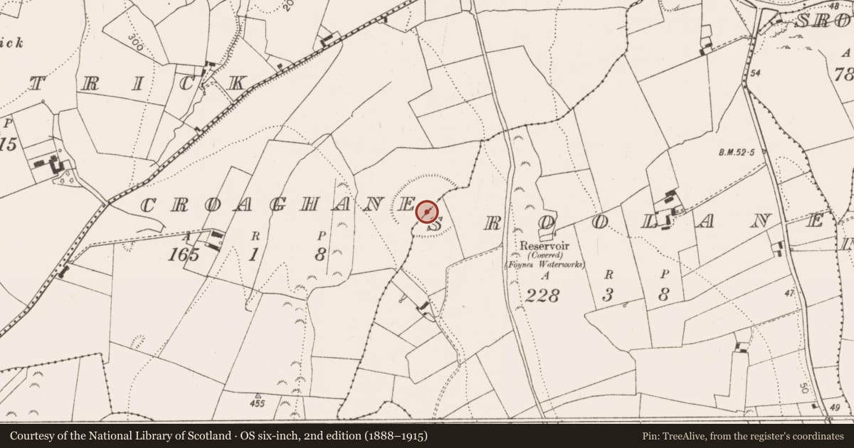
The record
- Townland
- Croaghane
- County
- Limerick
- Country
- Ireland
- Latest-edition OS map
- Hachured (1923)
- Coordinates
- 52.59091, -9.09897
- SMR number
- LI010-064001-
Slide toward Today to fade the historical sheet and see the modern map underneath.
David Rumsey Map Collection, Stanford LibrariesDavid Rumsey Map Collection, Stanford LibrariesDavid Rumsey Map Collection, Stanford LibrariesDavid Rumsey Map Collection, Stanford Libraries
4 historical maps cover this location, the earliest the 1790 map "Composite: Ireland." (David Rumsey Map Collection, Stanford Libraries).
Historical maps covering this location
- 1790 · Composite: Ireland. (David Rumsey Map Collection, Stanford Libraries)
- 1869 · Ireland. (David Rumsey Map Collection, Stanford Libraries)
- 1883 · Ireland 3. (David Rumsey Map Collection, Stanford Libraries)
- 1891 · Ireland 16 (David Rumsey Map Collection, Stanford Libraries)
This record in the National Monuments Service's Historic Environment Viewer ↗
The National Monuments Service's description
In pasture, at foot of E-facing slope. Roughly oval area (142m NE-SW; 93m NW-SE) enclosed by earthen bank (int. H 0.4m; ext. H 1.1m) SE->NE, bank levelled NE-SE but visible as cropmark on aerial photograph (CUCAP AVQ072); external fosse very indistinct but most apparent WSW->WNW (D c. 0.2m; Wth c. 1m). Enclosure crossed by field boundary on SW-NE axis; another field boundary travels SE from latter, crossing enclosing element to SE. Interior slopes down gently to E reflecting gradient of surrounding terrain; it is under grass as is enclosing element. Low section of bank to SE (Wth c. 5.6m) may be entrance; extending out from this is linear feature defined on SW side by low bank (H c. 0.25m) and on NE side by scarped edge (H 0.9m); this travels 31m until truncated by field boundary.
Compiled by: Denis Power
Date of upload: 26 August 2011
References
CUCAP - Cambridge University Collection of Aerial Photographs. Unit for Landscape Modelling, Department of Geography, University of Cambridge. See:https://www.cambridgeairphotos.com
Nearby in the register
- Cairn - unclassifiedunder 1 mi
- Barrow - ring-barrowunder 1 mi
- Road - road/trackwayunder 1 mi
- Ringfort - rathunder 1 mi
Other entries of the same register within about three miles of this one, by straight line.