Sites and Monuments Record · Ireland
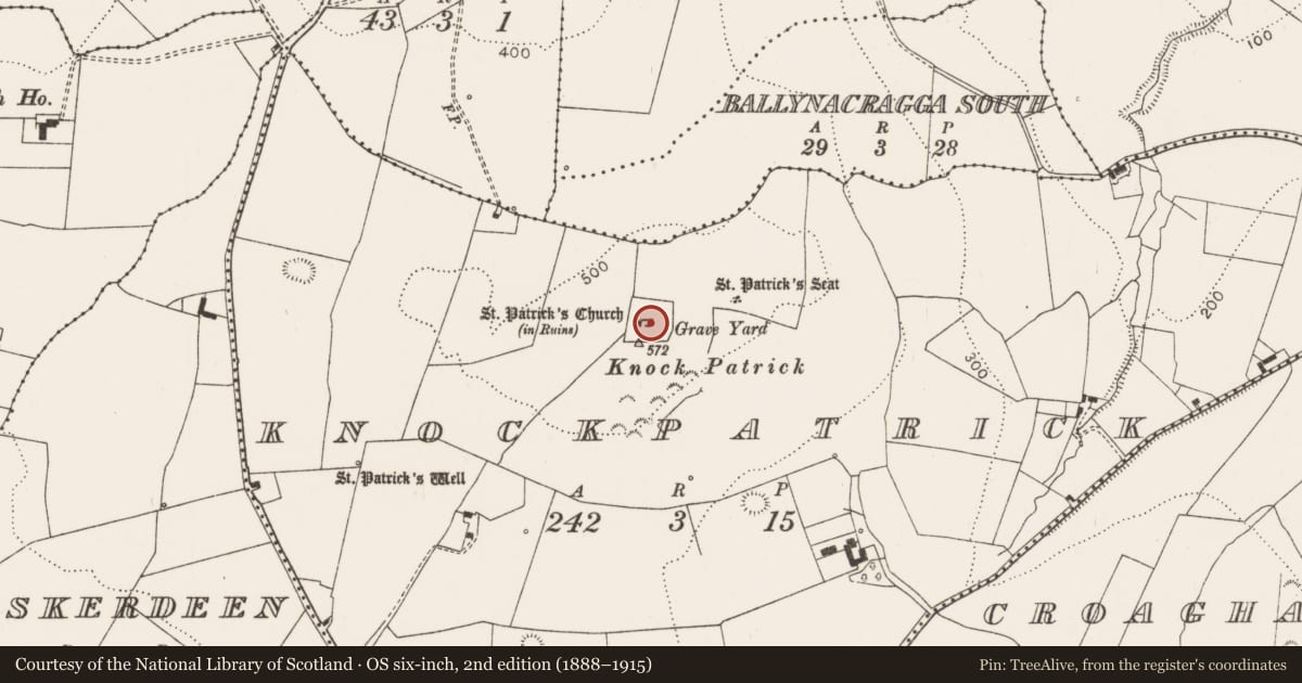
Graveyard
Knockpatrick, County Limerick, Ireland
The record
- Townland
- Knockpatrick
- County
- Limerick
- Country
- Ireland
- First-edition OS map
- Grave Yard
- Latest-edition OS map
- Grave Yard
- Coordinates
- 52.59454, -9.11418
- SMR number
- LI010-058002-
Slide toward Today to fade the historical sheet and see the modern map underneath.
David Rumsey Map Collection, Stanford LibrariesDavid Rumsey Map Collection, Stanford LibrariesDavid Rumsey Map Collection, Stanford LibrariesDavid Rumsey Map Collection, Stanford Libraries
4 historical maps cover this location, the earliest the 1790 map "Composite: Ireland." (David Rumsey Map Collection, Stanford Libraries).
Historical maps covering this location
- 1790 · Composite: Ireland. (David Rumsey Map Collection, Stanford Libraries)
- 1869 · Ireland. (David Rumsey Map Collection, Stanford Libraries)
- 1883 · Ireland 3. (David Rumsey Map Collection, Stanford Libraries)
- 1891 · Ireland 16 (David Rumsey Map Collection, Stanford Libraries)
This record in the National Monuments Service's Historic Environment Viewer ↗
The National Monuments Service's description
On summit of Knockpatrick Hill; approached from SW via farm trackway. Roughly square (57m E-W; 58m N-S) graveyard enclosed by stone wall. At centre fragmentary remains of St Patrick's Church (LI010-058001-). Interior filled with grave plots, except to N of church; most headstones 19th century, with a few 20th century; some late 18th and early 19th century burial vaults to E and W of church ruin. An altar has recently been constructed against inside face of enclosing wall on N side. Oblique aerial photograph (CUCAP AVQ071) taken 17/07/1968 of Knockpatrick shows church and graveyard standing on top of prominent hill with extensive views of the surrounding countryside with ringfort (LI010-003----) visible to N of graveryard.
Compiled by: Denis Power
Revised by: Caimin O'Brien
Date of revised upload: 21 January 2021
References
CUCAP - Cambridge University Collection of Aerial Photographs. Unit for Landscape Modelling, Department of Geography, University of Cambridge. See:https://www.cambridgeairphotos.com
Nearby in the register
- Churchunder 1 mi
- Ritual site - holy/saint's stoneunder 1 mi
- Ringfort - rathunder 1 mi
- Ritual site - holy wellunder 1 mi
Other entries of the same register within about three miles of this one, by straight line.