Sites and Monuments Record · Ireland
Ringfort - rath
Toberagarriff, County Limerick, Ireland
The record
- Townland
- Toberagarriff
- County
- Limerick
- Country
- Ireland
- First-edition OS map
- Hachured
- Latest-edition OS map
- Hachured - Indicated (1938)
- Coordinates
- 52.64679, -8.44336
- SMR number
- LI006-052----
Slide toward Today to fade the historical sheet and see the modern map underneath.
David Rumsey Map Collection, Stanford LibrariesDavid Rumsey Map Collection, Stanford LibrariesDavid Rumsey Map Collection, Stanford LibrariesDavid Rumsey Map Collection, Stanford Libraries
4 historical maps cover this location, the earliest the 1790 map "Composite: Ireland." (David Rumsey Map Collection, Stanford Libraries).
Historical maps covering this location
- 1790 · Composite: Ireland. (David Rumsey Map Collection, Stanford Libraries)
- 1869 · Ireland. (David Rumsey Map Collection, Stanford Libraries)
- 1891 · Ireland 16 (David Rumsey Map Collection, Stanford Libraries)
- 1904 · Sheet 13. (David Rumsey Map Collection, Stanford Libraries)
This record in the National Monuments Service's Historic Environment Viewer ↗
The National Monuments Service's description
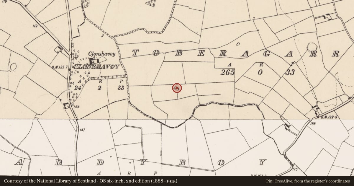
At the N end of an irregular-shaped field recently planted with conifer trees. Located 160m NW of a stream that forms the townland boundary with Maddyboy and 400m SE of the 18th century Clonshavoy House. The 1840 OS 6-inch map depicts a circular-shaped area enclosed by a bank surrounded by trees. The 1897 OS 25-inch map depicts a raised circular-shaped area (int. diam. approx. 32m) defined by a scarp. The interior has been planted with trees suggesting that this may have been a post-1700 tree-ring, possibly associated with Clonshavoy House. Google Earth orthoimage taken 28/06/2018 shows the heavily overgrown earthwork that has been fenced off from the surrounding coniferous tree plantation. Depicted as an antiquity on the 1840 OS 6-inch map which may suggest that this was an earlier monument reused in the post-1700 period as a landscaped feature.
See attached Google Earth orthoimage taken 28/06/2018
Compiled by: Fiona Rooney and Martin Fitzpatrick
Date of upload: 10 June 2020
Nearby in the register
- Earthworkunder 1 mi
- Ringfort - rathunder 1 mi
- Ringfort - rathunder 1 mi
- Enclosure - large enclosureunder 1 mi
Other entries of the same register within about three miles of this one, by straight line.