Sites and Monuments Record · Ireland
Cremation pit
Kilbane, County Limerick, Ireland
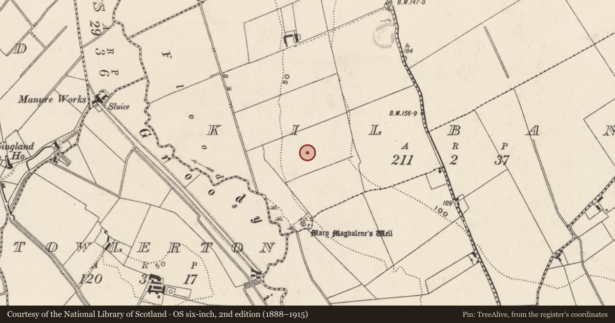
The record
- Townland
- Kilbane
- County
- Limerick
- Country
- Ireland
- Latest-edition OS map
- Not shown
- Coordinates
- 52.65639, -8.57168
- SMR number
- LI005-085005-
Slide toward Today to fade the historical sheet and see the modern map underneath.
David Rumsey Map Collection, Stanford LibrariesDavid Rumsey Map Collection, Stanford LibrariesDavid Rumsey Map Collection, Stanford LibrariesDavid Rumsey Map Collection, Stanford Libraries
4 historical maps cover this location, the earliest the 1790 map "Composite: Ireland." (David Rumsey Map Collection, Stanford Libraries).
Historical maps covering this location
- 1790 · Composite: Ireland. (David Rumsey Map Collection, Stanford Libraries)
- 1869 · Ireland. (David Rumsey Map Collection, Stanford Libraries)
- 1891 · Ireland 16 (David Rumsey Map Collection, Stanford Libraries)
- 1904 · Sheet 13. (David Rumsey Map Collection, Stanford Libraries)
This record in the National Monuments Service's Historic Environment Viewer ↗
The National Monuments Service's description
On gentle W-facing slope, in low-lying pasture, c. 200m NE of the Groody River. Not depicted on OS historic mapping. Identified within the interior of enclosure (LI005-085002-) by Avril Hayes in 2002 during testing (Licence No. 02E1787) in Field 2 in advance of a residential development including private houses, student accommodation and support facilities (Hayes 2003, 4). This uncovered a circular-shaped cremation pit (diam. 5m) which was then excavated (Licence No. 04E1454) by Avril Purcell in 2004 (Purcell 2004).
See attached plan extract from excavation report (Purcell 2004).
Compiled by: Alison McQueen and Vera Rahilly
Date of upload: 30 June 2020
References
Hayes, A. 2002 Archaeological test trenching investigations report at Fields 2 & 3, Kilbane, Co. Limerick. Unpublished report submitted to the National Monuments Service, Department of Arts, Heritage & the Gaeltacht, Dublin.
Purcell, A. 2004 Archaeological excavation, Kilbane, Castletroy, Co. Limerick. Licence No. 04E1454. Unpublished report submitted to the National Monuments Service, Department of Arts, Heritage & the Gaeltacht, Dublin.
Hayes, A. 2003 Report on archaeological monitoring at Fields 1-3, Kilbane II, Castletroy, Co. Limerick. Licence no. 02E1787. Unpublished report submitted to the National Monuments Service, Department of Arts, Heritage & the Gaeltacht, Dublin.
Purcell, A. 2004 Archaeological test trenching, Kilbane, Castletroy, Co. Limerick. Licence No. 04E1086. Unpublished report submitted to the National Monuments Service, Department of Arts, Heritage & the Gaeltacht, Dublin.
Nearby in the register
- Enclosureunder 1 mi
- Kiln - corn-dryingunder 1 mi
- Excavation - miscellaneousunder 1 mi
- Excavation - miscellaneousunder 1 mi
Other entries of the same register within about three miles of this one, by straight line.