Sites and Monuments Record · Ireland
Castle - tower house
Clonmore, County Louth, Ireland
The record
- Townland
- Clonmore
- County
- Louth
- Country
- Ireland
- First-edition OS map
- Indicated
- Latest-edition OS map
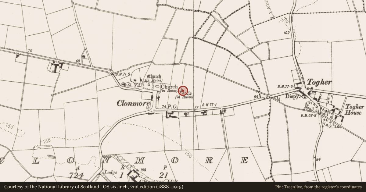
- Castle (in Ruins)
- Coordinates
- 53.83924, -6.31056
- SMR number
- LH018-023----
Slide toward Today to fade the historical sheet and see the modern map underneath.
David Rumsey Map Collection, Stanford LibrariesDavid Rumsey Map Collection, Stanford LibrariesDavid Rumsey Map Collection, Stanford LibrariesDavid Rumsey Map Collection, Stanford Libraries
4 historical maps cover this location, the earliest the 1636 map "Vltoniae Orientalis Pars" (David Rumsey Map Collection, Stanford Libraries).
Historical maps covering this location
- 1636 · Vltoniae Orientalis Pars (David Rumsey Map Collection, Stanford Libraries)
- 1799 · Ireland. (David Rumsey Map Collection, Stanford Libraries)
- 1811 · Ireland. (David Rumsey Map Collection, Stanford Libraries)
- 1891 · Ireland 16 (David Rumsey Map Collection, Stanford Libraries)
This record in the National Monuments Service's Historic Environment Viewer ↗
The National Monuments Service's description
Illustrated by Wright (1758, bk II, pl. XIV) as complete with rectangular corner-tower, now the only remains are those of the NW angle-tower. The tower, which is three storeys high, shows clear evidence of where the W wall of the main tower house has been broken away at the E end of the N face. The tower must have projected by c. 2.5m W from the line of the wall of the main building. The tower contains the remains of a stairwell which gave access to the first- and second-floor levels. There is also evidence for an E-W vault in the broken S face of the tower, but it is too small to have been that of the main ground-floor area and would appear to be the remains of the entranceway in the S end of the W wall. The tower is built of roughly coursed limestone rubble and greywacke. It has three slit opes with embrasures in the W wall and two in the N. (Murphy 1895, 318; CLAHJ 1921, 28)
The above description is derived from both the published 'Archaeological Inventory of County Louth' (Dublin: Stationery Office, 1986) and the 'Archaeological Survey of County Louth' (Dublin: Stationery Office, 1991). In certain instances the entries have been revised and updated in the light of recent research.
Date of upload: 17 July 2007
References
Wright, T. 1748 Louthiana: or an introduction to the antiquities of Ireland. London. Thomas Payne.
Murphy, D. 1895a The de Verdons of Louth. Journal of the Royal Society of Antiquaries of Ireland 25, 317-28.
McKenna, Rev. L. (ed.) 1921 Poem to Ó Conchobhair Sligigh: by Maol Sheachluinn na nUirsgeal Ó hUiginn. County Louth Archaeological and Historical Society, Journal, vol. 5, 1, 18-23.
Nearby in the register
- Churchunder 1 mi
- Graveyardunder 1 mi
- Churchunder 1 mi
- Barrow - unclassifiedunder 1 mi
Other entries of the same register within about three miles of this one, by straight line.