Sites and Monuments Record · Ireland
Cross-inscribed stone
Hunterstown, County Louth, Ireland
The record
- Townland
- Hunterstown
- County
- Louth
- Country
- Ireland
- First-edition OS map
- NULL
- Latest-edition OS map
- NULL
- Coordinates
- 53.83144, -6.52992
- SMR number
- LH017-090----
Slide toward Today to fade the historical sheet and see the modern map underneath.
David Rumsey Map Collection, Stanford LibrariesDavid Rumsey Map Collection, Stanford LibrariesDavid Rumsey Map Collection, Stanford LibrariesDavid Rumsey Map Collection, Stanford Libraries
4 historical maps cover this location, the earliest the 1636 map "Vltoniae Orientalis Pars" (David Rumsey Map Collection, Stanford Libraries).
Historical maps covering this location
- 1636 · Vltoniae Orientalis Pars (David Rumsey Map Collection, Stanford Libraries)
- 1799 · Ireland. (David Rumsey Map Collection, Stanford Libraries)
- 1811 · Ireland. (David Rumsey Map Collection, Stanford Libraries)
- 1891 · Ireland 16 (David Rumsey Map Collection, Stanford Libraries)
This record in the National Monuments Service's Historic Environment Viewer ↗
The National Monuments Service's description
The following description is derived from both the published 'Archaeological Inventory of County Louth' (Dublin: Stationery Office, 1986) and the 'Archaeological Survey of County Louth' (Dublin: Stationery Office, 1991). In certain instances the entries have been revised and updated in the light of recent research.
Date of upload/revision: 17 July 2007
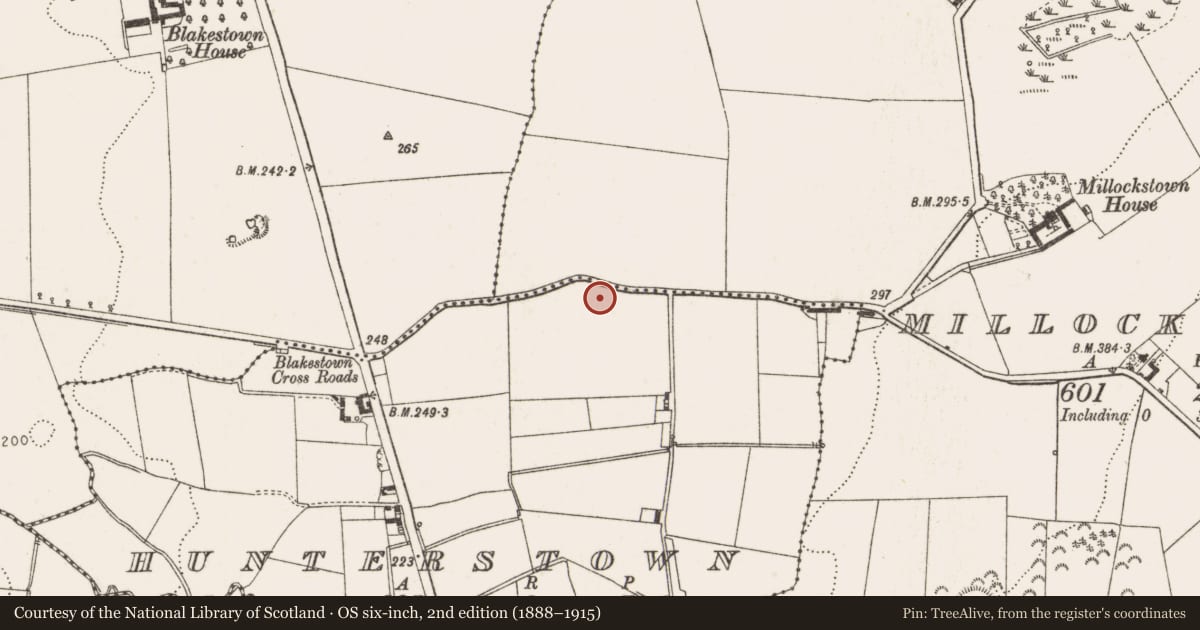
Locally known as the 'Soldier's Stone', embedded in S bank of the roadway c. a quarter of a mile E of Blakestown crossroads. It is a large, almost oval slab (max. L 1.92m, max. Wth 1.12m, T 0.04m) with rough surfaces and irregular edges. The decoration, which is confined to one end of the stone, consists of a broadly incised Latin cross with its head contained within a finely cut circle. The arms splay gradually towards their extremities and the top and base of the stem have pronounced irregularly-shaped splays. The basal portion of the stem has a crosslet with arms of unequal length. There are three small Latin crosses faintly incised on the stone close to the base of the main cross. (CLAJ 1946, 105; PRIA 61C, figs 13:3 and 28:5, pl. XXI:1)
Nearby in the register
- Souterrainunder 1 mi
- Ritual site - holy wellunder 1 mi
- Ringfort - rathunder 1 mi
- Burialunder 1 mi
Other entries of the same register within about three miles of this one, by straight line.