Sites and Monuments Record · Ireland
Castle - unclassified
Edmondstown, County Louth, Ireland
The record
- Townland
- Edmondstown
- County
- Louth
- Country
- Ireland
- First-edition OS map
- Not indicated
- Latest-edition OS map
- Not indicated
- Coordinates
- 53.90670, -6.62526
- SMR number
- LH013-006003-
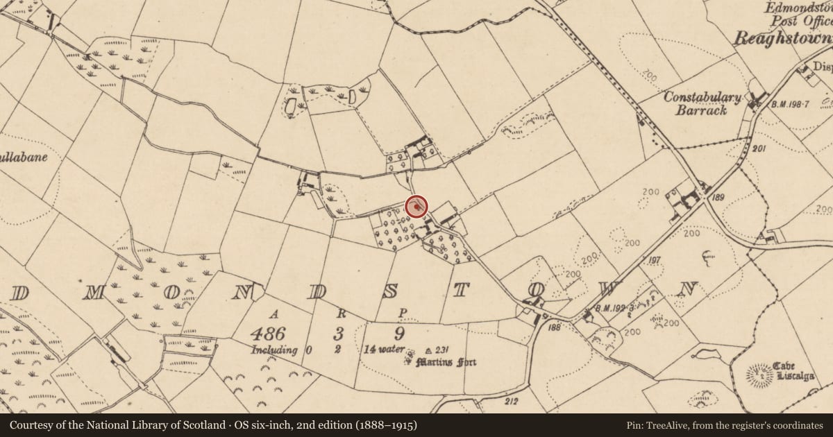
Slide toward Today to fade the historical sheet and see the modern map underneath.
David Rumsey Map Collection, Stanford LibrariesDavid Rumsey Map Collection, Stanford LibrariesDavid Rumsey Map Collection, Stanford LibrariesDavid Rumsey Map Collection, Stanford Libraries
4 historical maps cover this location, the earliest the 1636 map "Vltoniae Orientalis Pars" (David Rumsey Map Collection, Stanford Libraries).
Historical maps covering this location
- 1636 · Vltoniae Orientalis Pars (David Rumsey Map Collection, Stanford Libraries)
- 1790 · Composite: Ireland. (David Rumsey Map Collection, Stanford Libraries)
- 1811 · Ireland. (David Rumsey Map Collection, Stanford Libraries)
- 1891 · Ireland 16 (David Rumsey Map Collection, Stanford Libraries)
This record in the National Monuments Service's Historic Environment Viewer ↗
The National Monuments Service's description
A flat-topped hillock of rock outcrop surrounded by a wide drystone wall was said to be the site of a castle, of which there is no visible trace in 1966. Nearby farm buildings contain pieces of late medieval dressed stone (LH013-006004-), one bearing the date 1574 (LH013-006005-), and including the spandrel from a two-light ogee-headed window. Another stone has the coat of arms of the de Verduns and Plunkets (LH013-006006-). The stones are probably from a tower house, although no castle is depicted on the Down Survey (1656-8) barony map of Ardee in Clinton Rath townland (87), for which see this web-page accessed on 5 May, 2016 http://downsurvey.tcd.ie/down-survey-maps.php#bm=Atherdee&c=Louth.
The above description is derived from both the published 'Archaeological Inventory of County Louth' (Dublin: Stationery Office, 1986) and the 'Archaeological Survey of County Louth' (Dublin: Stationery Office, 1991). In certain instances the entries have been revised and updated in the light of recent research.
Date of revision: 5 May 2016
Nearby in the register
- Armorial plaqueunder 1 mi
- Architectural fragmentunder 1 mi
- Inscribed stoneunder 1 mi
- Ritual site - holy wellunder 1 mi
Other entries of the same register within about three miles of this one, by straight line.