Sites and Monuments Record · Ireland
Church
Richard Taaffe'S Holding, County Louth, Ireland
The record
- Townland
- Richard Taaffe'S Holding
- County
- Louth
- Country
- Ireland
- First-edition OS map
- Not indicated
- Latest-edition OS map
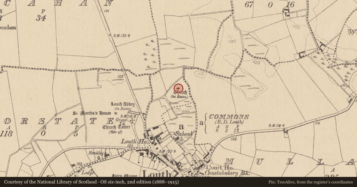
- Church (in Ruins)
- Coordinates
- 53.95443, -6.54099
- SMR number
- LH011-115001-
Slide toward Today to fade the historical sheet and see the modern map underneath.
David Rumsey Map Collection, Stanford LibrariesDavid Rumsey Map Collection, Stanford LibrariesDavid Rumsey Map Collection, Stanford LibrariesDavid Rumsey Map Collection, Stanford Libraries
4 historical maps cover this location, the earliest the 1636 map "Vltoniae Orientalis Pars" (David Rumsey Map Collection, Stanford Libraries).
Historical maps covering this location
- 1636 · Vltoniae Orientalis Pars (David Rumsey Map Collection, Stanford Libraries)
- 1799 · Ireland. (David Rumsey Map Collection, Stanford Libraries)
- 1811 · Ireland. (David Rumsey Map Collection, Stanford Libraries)
- 1891 · Ireland 16 (David Rumsey Map Collection, Stanford Libraries)
This record in the National Monuments Service's Historic Environment Viewer ↗
The National Monuments Service's description
The following description is derived from both the published 'Archaeological Inventory of County Louth' (Dublin: Stationery Office, 1986) and the 'Archaeological Survey of County Louth' (Dublin: Stationery Office, 1991). In certain instances the entries have been revised and updated in the light of recent research.
Date of upload/revision: 17 July 2007
Possible church of SS Peter and Paul, in ruins and consisting of a fragment of a N wall known locally as the 'Pinnacle'. It is featureless except for a beam slot at first-floor level in its S face. Slight remains of the W wall project from its W end so that the remaining fragment is at the NW angle of the structure. It has been identified as an Augustinian house (CLAJ 1916, 62-3), but Bradley (CLAJ 1985, 14-15) amongst others considers this to be unlikely because of the proximity of Louth Abbey (LH011-115005-) and because the site is not large enough to accommodate a substantial structure. (CLAJ 1942, 106; CLAJ 1985, 14-15)
Nearby in the register
- Religious house - Augustinian canonsunder 1 mi
- Souterrainunder 1 mi
- Graveyardunder 1 mi
- Holed stoneunder 1 mi
Other entries of the same register within about three miles of this one, by straight line.