Sites and Monuments Record · Ireland
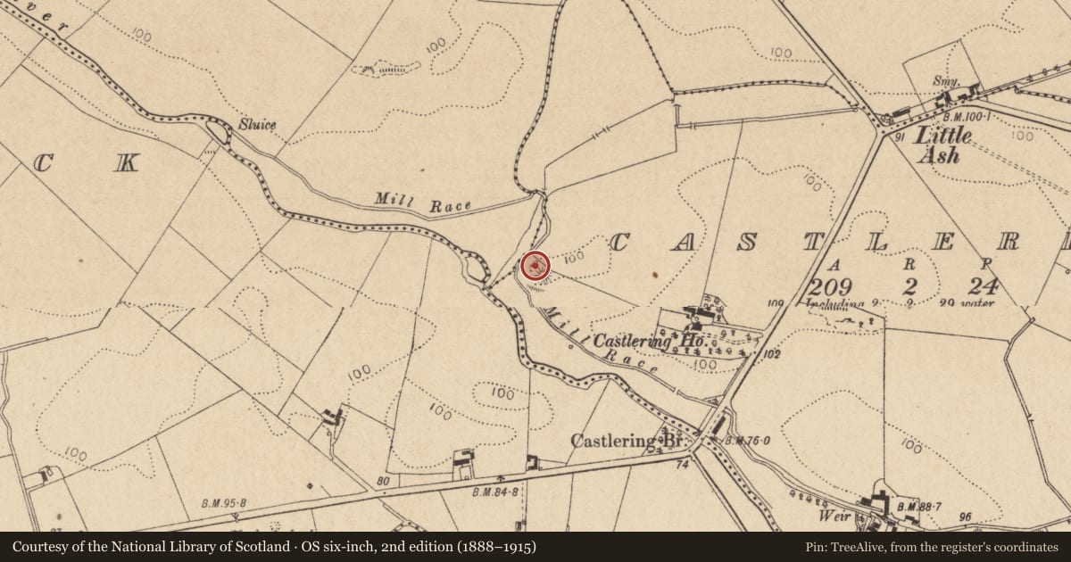
Castle - motte and bailey
Castlering, County Louth, Ireland
The record
- Townland
- Castlering
- County
- Louth
- Country
- Ireland
- First-edition OS map
- Not indicated
- Latest-edition OS map
- Hachured
- Coordinates
- 53.97630, -6.53229
- SMR number
- LH006-076001-
Slide toward Today to fade the historical sheet and see the modern map underneath.
David Rumsey Map Collection, Stanford LibrariesDavid Rumsey Map Collection, Stanford LibrariesDavid Rumsey Map Collection, Stanford LibrariesDavid Rumsey Map Collection, Stanford Libraries
4 historical maps cover this location, the earliest the 1636 map "Vltoniae Orientalis Pars" (David Rumsey Map Collection, Stanford Libraries).
Historical maps covering this location
- 1636 · Vltoniae Orientalis Pars (David Rumsey Map Collection, Stanford Libraries)
- 1799 · Ireland. (David Rumsey Map Collection, Stanford Libraries)
- 1811 · Ireland. (David Rumsey Map Collection, Stanford Libraries)
- 1891 · Ireland 16 (David Rumsey Map Collection, Stanford Libraries)
This record in the National Monuments Service's Historic Environment Viewer ↗
The National Monuments Service's description
Situated on a low ridge of possible rock outcrop close to the E bank of the River Fane, and consisting of a steep-sided, almost circular mound (max. H c. 6m, max. diam. at base 31m, at top c. 11m) with a crescent-shaped bailey at the W defined by an escarpment. There is a wide shallow fosse (Wth 7.5m, D 0.3m) between the mound and the bailey (max. Wth 10.5m, max. L 38m, H c. 5m). There is no evidence of a fosse surrounding either the motte or the bailey. Wright (1758, bk I, pl. XIII) shows a hexagonal feature (LH006-076002-) encompassing the summit of the mound. A basal course of stone can still be seen at the ENE side and a slight narrow bank at the SW. (Wright 1758, bk I ,pl. XIII,; Orpen 1908, 252; Quinn 1911, 429-30).
The above description is derived from both the published 'Archaeological Inventory of County Louth' (Dublin: Stationery Office, 1986) and the 'Archaeological Survey of County Louth' (Dublin: Stationery Office, 1991). In certain instances the entries have been revised and updated in the light of recent research.
Date of upload: 17 July 2007
References
Wright, T. 1748 Louthiana: or an introduction to the antiquities of Ireland. London. Thomas Payne.
Orpen, G.H. 1908 Mottes and Norman castles in County Louth. Journal of the Royal Society of Antiquaries of Ireland 38, 241-69.
Quinn, Rev. J. 1911 Louthiana: ancient and modern. Castle Ring Moat. County Louth Archaeological and Historical Society Journal, vol. 2, 4. 429-30.
Nearby in the register
- Buildingunder 1 mi
- Standing stoneunder 1 mi
- Churchunder 1 mi
- Enclosureunder 1 mi
Other entries of the same register within about three miles of this one, by straight line.