Sites and Monuments Record · Ireland
Cross - High cross
Faughart Upper, County Louth, Ireland
The record
- Townland
- Faughart Upper
- County
- Louth
- Country
- Ireland
- First-edition OS map
- Not indicated
- Latest-edition OS map
- Not indicated
- Coordinates
- 54.05168, -6.38447
- SMR number
- LH004-097006-
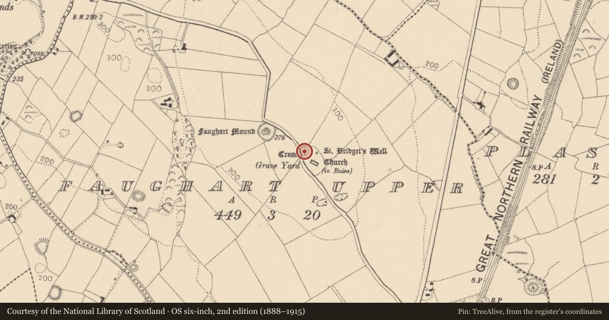
Slide toward Today to fade the historical sheet and see the modern map underneath.
David Rumsey Map Collection, Stanford LibrariesDavid Rumsey Map Collection, Stanford LibrariesDavid Rumsey Map Collection, Stanford LibrariesDavid Rumsey Map Collection, Stanford Libraries
4 historical maps cover this location, the earliest the 1636 map "Vltoniae Orientalis Pars" (David Rumsey Map Collection, Stanford Libraries).
Historical maps covering this location
- 1636 · Vltoniae Orientalis Pars (David Rumsey Map Collection, Stanford Libraries)
- 1799 · Ireland. (David Rumsey Map Collection, Stanford Libraries)
- 1811 · Ireland. (David Rumsey Map Collection, Stanford Libraries)
- 1891 · Ireland 16 (David Rumsey Map Collection, Stanford Libraries)
This record in the National Monuments Service's Historic Environment Viewer ↗
The National Monuments Service's description
This stands roughly at the centre of a circular mound (LH004-097004-). Excavations in 1966 indicated that this must have been relocated to this position within the graveyard in modern times. It consists of a squarish granite block with a flat top in which there is a socket for tenon, most probably for a high cross. A fragment of what appears to have been the remains of this cross was recovered during the restoration of a small portion of the graveyard wall c. 1997. The fragment (dims. 0.34m by 0.31m) consists of a portion of carved granite, representing the central part of a small high cross. On one side there is a prominent boss (diam. 0.1m), which stands proud of the surface. The decoration on the other sides cosnsits of a circular area (diam. 0.14m) defined by a ring with a central ‘cupmark’. This fragment is in Dundalk Museum (LH007-190----).
Compiled by: Paul Walsh
Date of upload: 26 June 2014
References
Condit, T. and Buckley, V. 2007 Faughart, Co. Louth - the hill of heroes, saints, battles and boundaries. Archaeology Ireland. Heritage Guide No. 37.
Nearby in the register
- Round towerunder 1 mi
- Architectural fragmentunder 1 mi
- Moundunder 1 mi
- Ecclesiastical enclosureunder 1 mi
Other entries of the same register within about three miles of this one, by straight line.