Sites and Monuments Record · Ireland
Castle - tower house
Abbeyshrule, County Longford, Ireland
The record
- Townland
- Abbeyshrule
- County
- Longford
- Country
- Ireland
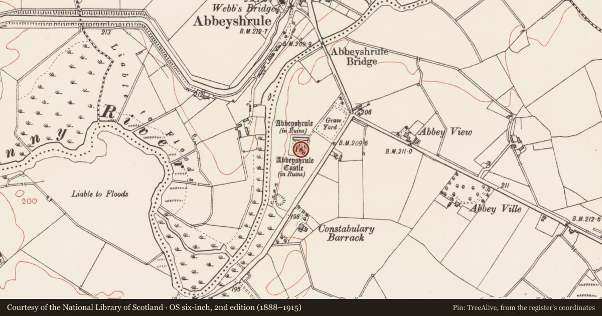
- Latest-edition OS map
- Abbeyshrule Castle (in Ruins)
- Coordinates
- 53.57938, -7.65820
- SMR number
- LF023-113001-
Slide toward Today to fade the historical sheet and see the modern map underneath.
David Rumsey Map Collection, Stanford LibrariesDavid Rumsey Map Collection, Stanford LibrariesDavid Rumsey Map Collection, Stanford LibrariesDavid Rumsey Map Collection, Stanford Libraries
4 historical maps cover this location, the earliest the 1790 map "Composite: Ireland." (David Rumsey Map Collection, Stanford Libraries).
Historical maps covering this location
- 1790 · Composite: Ireland. (David Rumsey Map Collection, Stanford Libraries)
- 1811 · Ireland. (David Rumsey Map Collection, Stanford Libraries)
- 1869 · Ireland. (David Rumsey Map Collection, Stanford Libraries)
- 1891 · Ireland 16 (David Rumsey Map Collection, Stanford Libraries)
This record in the National Monuments Service's Historic Environment Viewer ↗
The National Monuments Service's description
On the SE corner of the claustral range of buildings of the Cistercian abbey (LF023-113----) and within a graveyard (LF023-113016-). This four-storey tower house (ext. dims. 5.8m E–W; 5.4m N–S) is built of roughly coursed rubble and is densely overgrown with ivy. The S and W walls have collapsed and survive only to the first-floor level. The doorway was probably in the N wall close to the NE angle but this area is obscured by collapse. The partially collapsed spiral stairwell is in this angle and it accessed each floor level via a mural passage. There is a barrel vault over the inaccessible ground floor. In the E wall at first-floor level there is a plain, flat-headed ope and on the second floor, directly above it, there is a large fireplace. Also on this wall, at battlement level, are corbels supporting a chimney stack. This was almost certainly a residential tower probably dating to the post-Dissolution occupation of the abbey in the late 16th century.
Compiled by: Patrick F. O'Donovan
Date of upload: 6 June 2012
Nearby in the register
- Graveyardunder 1 mi
- Religious house - Cistercian monksunder 1 mi
- Cross-slabunder 1 mi
- Graveslabunder 1 mi
Other entries of the same register within about three miles of this one, by straight line.