Sites and Monuments Record · Ireland
Burial ground
Glen, County Longford, Ireland
The record
- Townland
- Glen
- County
- Longford
- Country
- Ireland
- First-edition OS map
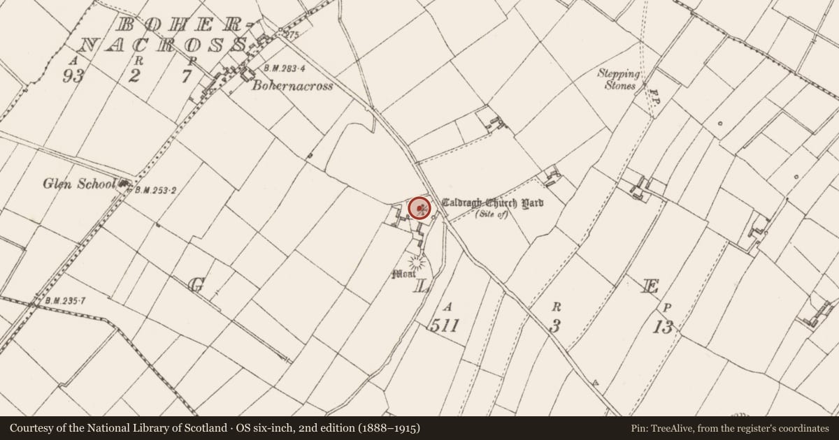
- Caldragh Church Yard
- Latest-edition OS map
- Caldragh Church Yard (Site of)
- Coordinates
- 53.66767, -7.61120
- SMR number
- LF020-023----
Slide toward Today to fade the historical sheet and see the modern map underneath.
David Rumsey Map Collection, Stanford LibrariesDavid Rumsey Map Collection, Stanford LibrariesDavid Rumsey Map Collection, Stanford LibrariesDavid Rumsey Map Collection, Stanford Libraries
4 historical maps cover this location, the earliest the 1790 map "Composite: Ireland." (David Rumsey Map Collection, Stanford Libraries).
Historical maps covering this location
- 1790 · Composite: Ireland. (David Rumsey Map Collection, Stanford Libraries)
- 1811 · Ireland. (David Rumsey Map Collection, Stanford Libraries)
- 1869 · Ireland. (David Rumsey Map Collection, Stanford Libraries)
- 1891 · Ireland 16 (David Rumsey Map Collection, Stanford Libraries)
This record in the National Monuments Service's Historic Environment Viewer ↗
The National Monuments Service's description
On a S-facing slope. Named 'Caldragh Church Yard' on the 1837 ed. of the OS 6-inch map and 'Site of' on the 1914 ed. This townland was known as: 'Gleann na n-Easbog, Vallis Episcoporum, Valley of the Bishops’ and was so named because ‘it contains an old graveyard, in which, according to tradition, four bishops are buried' (OSNB, Ardagh parish, 1836-7, book 4, 51). The OS Letters (1837) refer to it as a 'churchyard’ (OSL, 39). The English form of the name 'Caldragh' derives from the Irish Cealltrach meaning ‘old churchyard’: the element ceall meaning ‘church’, but the name was generally used to refer to a place of burial. The name has also come to be associated with locations used as the burial grounds of unbaptised children. However, there is no evidence to suggest that a children's burial ground existed here. The site is occupied by a modern house. A quantity of bone was discovered during the excavation of the house foundations (local information).
Compiled by: Patrick F. O'Donovan, Caimin O'Brien
Date of upload: 15 April 2013
Nearby in the register
- Castle - motteunder 1 mi
- Ringfort - rathunder 1 mi
- Earthworkunder 1 mi
- Ringfort - rathunder 1 mi
Other entries of the same register within about three miles of this one, by straight line.