Sites and Monuments Record · Ireland
Graveyard
Glebe (Rathcline By., Rathcline ED), County Longford, Ireland
The record
- Townland
- Glebe (Rathcline By., Rathcline ED)
- County
- Longford
- Country
- Ireland
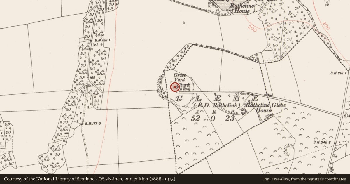
- Latest-edition OS map
- Grave Yard
- Coordinates
- 53.64459, -8.00387
- SMR number
- LF017-013004-
Slide toward Today to fade the historical sheet and see the modern map underneath.
David Rumsey Map Collection, Stanford LibrariesDavid Rumsey Map Collection, Stanford LibrariesDavid Rumsey Map Collection, Stanford LibrariesDavid Rumsey Map Collection, Stanford Libraries
4 historical maps cover this location, the earliest the 1790 map "Composite: Ireland." (David Rumsey Map Collection, Stanford Libraries).
Historical maps covering this location
- 1790 · Composite: Ireland. (David Rumsey Map Collection, Stanford Libraries)
- 1811 · Ireland. (David Rumsey Map Collection, Stanford Libraries)
- 1869 · Ireland. (David Rumsey Map Collection, Stanford Libraries)
- 1891 · Ireland 16 (David Rumsey Map Collection, Stanford Libraries)
This record in the National Monuments Service's Historic Environment Viewer ↗
The National Monuments Service's description
Centrally located within an ecclesiastical enclosure (LF017-013003-). This subrectangular graveyard (48m E-W; 45m N-S) is enclosed by a stone wall. Access is via a wrought-iron gate with an adjacent stone stile at the S end of the E wall. A late-medieval church (LF017-013001-) is centrally located within the interior. Midway along the S wall there is a blocked up, pointed arch gateway (H 3m; Wth 2.4m), which appears to have been the original entrance to the graveyard. The wall (ext. H 1m; int. H 1.6m) on either side of it measures approx. 0.9m thick and it appears to be medieval in date. The W side of the gateway is supported by a buttress (D 0.85m; Wth 0.9m) that projects to the S beyond the graveyard wall. Memorials date from the mid-17th century to the present day; the earliest legible example (LF017-013006-) is dated 1650 (Lennon 2005). A graveslab (LF017-013005-) within the church is dated 1696. (ITA Survey 1944; Cahill 1984, 184-5)
Compiled by: Caimin O'Brien
Date of upload: 4 June 2013
Nearby in the register
- Graveslabunder 1 mi
- Churchunder 1 mi
- Ecclesiastical enclosureunder 1 mi
- Sheela-na-gigunder 1 mi
Other entries of the same register within about three miles of this one, by straight line.