Sites and Monuments Record · Ireland
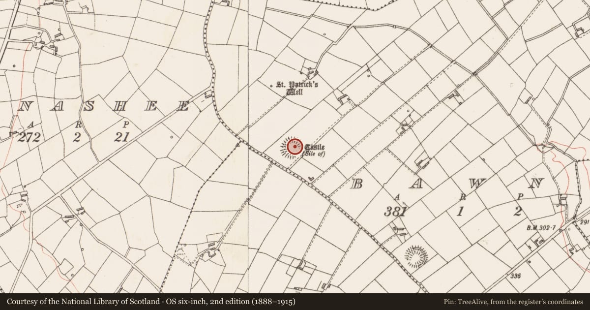
Castle - unclassified
Bawn (Longford By.), County Longford, Ireland
The record
- Townland
- Bawn (Longford By.)
- County
- Longford
- Country
- Ireland
- First-edition OS map
- Castle
- Latest-edition OS map
- Castle (Site of)
- Coordinates
- 53.79319, -7.77937
- SMR number
- LF009-002001-
Slide toward Today to fade the historical sheet and see the modern map underneath.
David Rumsey Map Collection, Stanford LibrariesDavid Rumsey Map Collection, Stanford LibrariesDavid Rumsey Map Collection, Stanford LibrariesDavid Rumsey Map Collection, Stanford Libraries
4 historical maps cover this location, the earliest the 1790 map "Composite: Ireland." (David Rumsey Map Collection, Stanford Libraries).
Historical maps covering this location
- 1790 · Composite: Ireland. (David Rumsey Map Collection, Stanford Libraries)
- 1811 · Ireland. (David Rumsey Map Collection, Stanford Libraries)
- 1869 · Ireland. (David Rumsey Map Collection, Stanford Libraries)
- 1891 · Ireland 16 (David Rumsey Map Collection, Stanford Libraries)
This record in the National Monuments Service's Historic Environment Viewer ↗
The National Monuments Service's description
Within the interior of a rath (LF009-002002-). Noted in 1837 as being one of the seven castles of the O’Farrell’s in Annaly (OSL, 70) and in the OS Name Book as 'Bawn fort and the ruins of an old castle to its northwest point’ (OSNB, Killoe parish, 1836-7, book 15, no. 295). However, a building, aligned NW-SW, bearing the designation 'Castle' is marked on the 1837 edition of the OS map at the E extent of the rath. A report in 1966 (SMR file) noted that the castle and the rath were levelled. No visible surface trace survives. The rath may have been reused as the bawn of the castle.
Compiled by: Patrick F. O'Donovan
Date of upload: 1 October 2012
References
OSL - Ordnance Survey Letters. Letters written by members of the Ordnance Survey's 'Topographical Department' (T. O'Conor, A. O'Curry, E. Curry, J. O'Donovan and P. O'Keeffe) sent to headquarters from the field (1834-41). MSS in Royal Irish Academy.
OSNB - Ordnance Survey Name Books. Pro-forma books arranged by Civil Parish for recording townland and other name-forms and compiled in the course of the OS 6-inch survey 1824-1841. The name books also include minor names and incidental references to antiquities. National Archives of Ireland.
Nearby in the register
- Ringfort - rathunder 1 mi
- Bullaun stoneunder 1 mi
- Kiln - limeunder 1 mi
- Ringfort - rathunder 1 mi
Other entries of the same register within about three miles of this one, by straight line.