Sites and Monuments Record · Ireland
Ringfort - rath
Tully (Leitrim By., Carrick-on-Shannon ED), County Leitrim, Ireland
The record
- Townland
- Tully (Leitrim By., Carrick-on-Shannon ED)
- County
- Leitrim
- Country
- Ireland
- First-edition OS map
- Not indicated
- Latest-edition OS map
- Not indicated
- Coordinates
- 53.93758, -8.03847
- SMR number
- LE031-110----
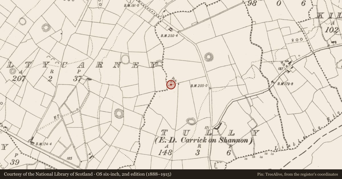
Slide toward Today to fade the historical sheet and see the modern map underneath.
David Rumsey Map Collection, Stanford LibrariesDavid Rumsey Map Collection, Stanford LibrariesDavid Rumsey Map Collection, Stanford LibrariesDavid Rumsey Map Collection, Stanford Libraries
4 historical maps cover this location, the earliest the 1790 map "Composite: Ireland." (David Rumsey Map Collection, Stanford Libraries).
Historical maps covering this location
- 1790 · Composite: Ireland. (David Rumsey Map Collection, Stanford Libraries)
- 1811 · Ireland. (David Rumsey Map Collection, Stanford Libraries)
- 1869 · Ireland. (David Rumsey Map Collection, Stanford Libraries)
- 1891 · Ireland 16 (David Rumsey Map Collection, Stanford Libraries)
This record in the National Monuments Service's Historic Environment Viewer ↗
The National Monuments Service's description
Located on a knoll at the SW end of a NE-SW drumlin ridge. It was first identified by Susan Curran as part of an M.A. Thesis with University College Dublin using a LiDAR survey dataset commissioned by Leitrim County Council and the National Roads Authority. This is a subcircular grass-covered area (dims 32.5m N-S; 28m E-W) defined by a scarp (H 0.3m at N; 0.5m at E and S to 0.8m at W), with traces of a fosse at N (Wth of top 3m; D 0.2m) and S (Wth of top 5m; D 0.1m) across the ridge of the drumlin. There is no identifiable entrance but the interior is overlain by an ENE-WSW field bank and drain S of the centre, and there is a N-S track through the field bank. There is a rectangular grass-covered mound (dims of base 7m E-W; 4.7m N-S; dims of top 6.2m E-W; 3.6m N-S; H 0.4-0.6m) with some trees outside the perimeter at NNE, which may have been built by the Ordinance Survey to provide a spot-height (276') on top of the hill. Rath (LE031-119----) is c. 35m to the W in Kiltycarney townland and rath (LE031-053----) is c. 85m to the NW.
Compiled by: Michael Moore
Date of upload: 9 April, 2013
Amended: 15 April, 2014; 11 May, 2015
Nearby in the register
- Ringfort - rathunder 1 mi
- Ringfort - rathunder 1 mi
- Ringfort - rathunder 1 mi
- Enclosureunder 1 mi
Other entries of the same register within about three miles of this one, by straight line.