Sites and Monuments Record · Ireland
House - 16th/17th century
Clooncorick, County Leitrim, Ireland
The record
- Townland
- Clooncorick
- County
- Leitrim
- Country
- Ireland
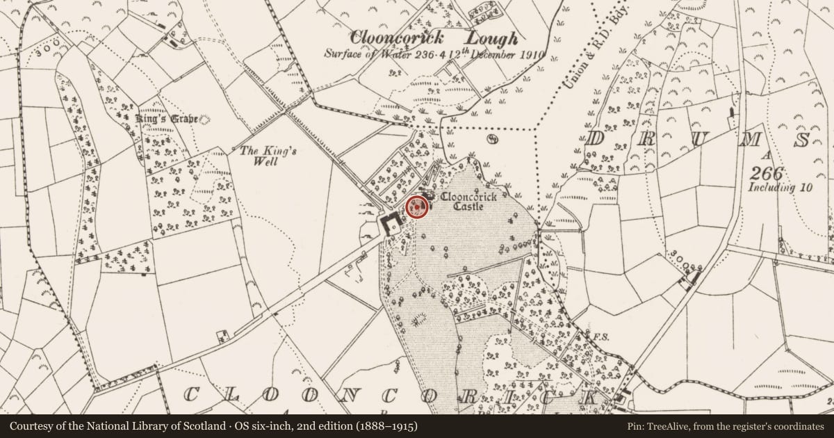
- First-edition OS map
- Clooncorick Castle
- Latest-edition OS map
- Clooncorick Castle
- Coordinates
- 53.98668, -7.63893
- SMR number
- LE030-032----
Slide toward Today to fade the historical sheet and see the modern map underneath.
David Rumsey Map Collection, Stanford LibrariesDavid Rumsey Map Collection, Stanford LibrariesDavid Rumsey Map Collection, Stanford LibrariesDavid Rumsey Map Collection, Stanford Libraries
4 historical maps cover this location, the earliest the 1790 map "Composite: Ireland." (David Rumsey Map Collection, Stanford Libraries).
Historical maps covering this location
- 1790 · Composite: Ireland. (David Rumsey Map Collection, Stanford Libraries)
- 1811 · Ireland. (David Rumsey Map Collection, Stanford Libraries)
- 1869 · Ireland. (David Rumsey Map Collection, Stanford Libraries)
- 1891 · Ireland 16 (David Rumsey Map Collection, Stanford Libraries)
This record in the National Monuments Service's Historic Environment Viewer ↗
The National Monuments Service's description
Situated on rock outcrop in an undulating landscape. Shane Oge O'Rourke received a grant of 1800 acres as the manor of Clooncoric in 1629 (Cal. pat. rolls Ire., Chas. I, 511), and he or his descendants may have built a house here in the 17th century, although he was at least the fourth generation of the family resident here (Burke 1884, 762) in a territory known as Magh Anaighe (McDermott 2019, 121). A building was added in the 18th century, but all the structures were removed c. 1920. No archaeological or architectural feature is visible at ground level. (McParlan 1802, 91; Lewis 1837, vol. 1, 279; Williams 1996)
The above description is derived from 'The Archaeological Inventory of County Leitrim' compiled by Michael J. Moore (Dublin: Stationery Office, 2003). In certain instances the entries have been revised and updated in the light of recent research.
Compiled by: Michael Moore
Date of revised upload: 16 October 2019
Amended: 3 January 2020
References
McDermott, J. J. 2019 Late medieval strongholds of the Gaelic Irish in County Leitrim. in In Kelly, L. and Scott, B. Leitrim: History and Society, 103-27. Dublin, Geography Publications
Burke, Sir B. 1884 The general armory of England, Scotland, Ireland and Wales. London. Harrison.
Cal. pat. rolls Ire., Chas I - Calendar of patent and close rolls of chancery of Ireland, of the reign of Charles I, years 1 to 8 inclusive, ed. James Morrin (Dublin, 1863)
McParlan, M.D. 1802 Statistical survey of the county Leitrim. Dublin.
Lewis, S. 1837 A topographical dictionary of Ireland, 2 vols. London. Lewis and Co.
Williams, M. 1996 Clooncorrick Castle through the ages. In R. Hackett and M. Reilly, Carrigallen, a history, 343-5. Privately published.
Nearby in the register
- Crannogunder 1 mi
- Souterrainunder 1 mi
- Moundunder 1 mi
- Standing stone - pairunder 1 mi
Other entries of the same register within about three miles of this one, by straight line.