Sites and Monuments Record · Ireland
Settlement deserted - medieval
Commons, County Leitrim, Ireland
The record
- Townland
- Commons
- County
- Leitrim
- Country
- Ireland
- First-edition OS map
- Ancient Town
- Latest-edition OS map
- Cashel (Ancient Town)
- Coordinates
- 54.01894, -7.83596
- SMR number
- LE025-096005-
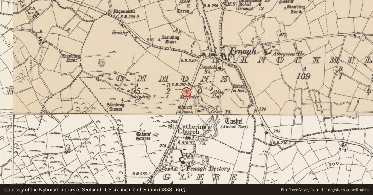
Slide toward Today to fade the historical sheet and see the modern map underneath.
David Rumsey Map Collection, Stanford LibrariesDavid Rumsey Map Collection, Stanford LibrariesDavid Rumsey Map Collection, Stanford LibrariesDavid Rumsey Map Collection, Stanford Libraries
4 historical maps cover this location, the earliest the 1790 map "Composite: Ireland." (David Rumsey Map Collection, Stanford Libraries).
Historical maps covering this location
- 1790 · Composite: Ireland. (David Rumsey Map Collection, Stanford Libraries)
- 1869 · Ireland. (David Rumsey Map Collection, Stanford Libraries)
- 1891 · Ireland 16 (David Rumsey Map Collection, Stanford Libraries)
- 1922 · Ireland - northern section. (David Rumsey Map Collection, Stanford Libraries)
This record in the National Monuments Service's Historic Environment Viewer ↗
The National Monuments Service's description
In 1944 the ITA Survey recorded that the land surrounding Fenagh Abbey (LE025-096001-) on both sides of the road (Fenagh/Mohill) which is known as the 'Commons' was 'bristling with lichen-covered blocks of stone and partly concealed foundations' (Blaney 1944), which may be the remains of a deserted medieval settlement associated with the abbey. In 1969 Norman and St. Joseph identified in their aerial photographs traces of, 'faint earthworks of the ancient settlement' and outside the enclosure (LE025-096004-) a good deal of disturbed ground is visible, perhaps indicating considerable expansion and the settlement of monastic clients or craftsmen-apprentices' (Norman and St. Joseph 1969, 109-10).
Compiled by Caimin O'Brien
Date of upload/revision: 16 December 2011
This monument is subject to a preservation order made under the National Monuments Acts 1930 to 2014 (PO no. 3/1994).
References
Norman, E.R. and St Joseph, J.K. 1969a The early development of Irish society. The evidence of aerial photography. Cambridge University Press.
Blaney, N. 1944 Ballinamore Library, file nos. 124-47. Unpublished notes.
Nearby in the register
- Road - road/trackwayunder 1 mi
- Wall monumentunder 1 mi
- Mausoleumunder 1 mi
- Churchunder 1 mi
Other entries of the same register within about three miles of this one, by straight line.