Sites and Monuments Record · Ireland
Megalithic tomb - court tomb
Tullyskeherny (Rosclogher By.), County Leitrim, Ireland
The record
- Townland
- Tullyskeherny (Rosclogher By.)
- County
- Leitrim
- Country
- Ireland
- First-edition OS map
- Not indicated
- Latest-edition OS map
- Not indicated
- Coordinates
- 54.36964, -8.10060
- SMR number
- LE005-022----
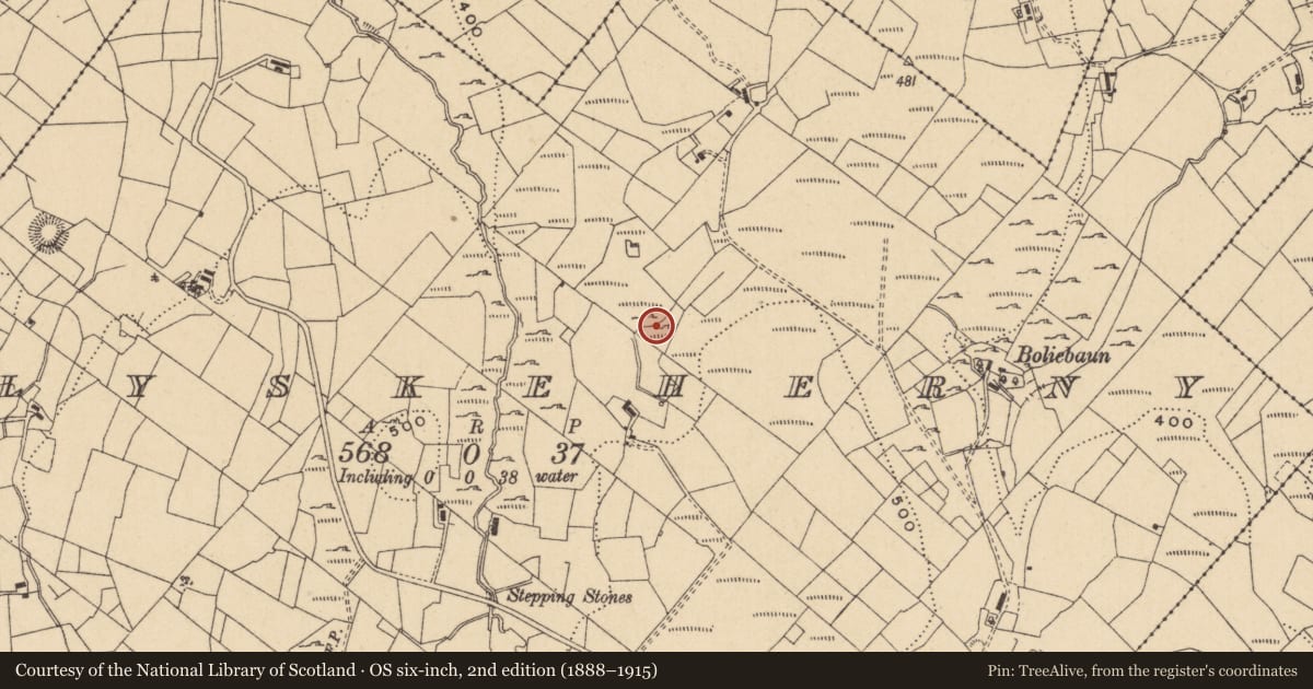
Slide toward Today to fade the historical sheet and see the modern map underneath.
David Rumsey Map Collection, Stanford LibrariesDavid Rumsey Map Collection, Stanford LibrariesDavid Rumsey Map Collection, Stanford LibrariesDavid Rumsey Map Collection, Stanford Libraries
4 historical maps cover this location, the earliest the 1869 map "Ireland." (David Rumsey Map Collection, Stanford Libraries).
Historical maps covering this location
- 1869 · Ireland. (David Rumsey Map Collection, Stanford Libraries)
- 1891 · Ireland 16 (David Rumsey Map Collection, Stanford Libraries)
- 1904 · Sheet 4. (David Rumsey Map Collection, Stanford Libraries)
- 1922 · Ireland - northern section. (David Rumsey Map Collection, Stanford Libraries)
This record in the National Monuments Service's Historic Environment Viewer ↗
The National Monuments Service's description
Situated on a shelf on the N-facing slope of a S-N spur of Saddle Hill, with fairly level ground in the immediate vicinity W-N-E. It is located within a mature coniferous forest and is not recorded on any map but was first reported by Ciarán Rock. It consists of the remains of a cairn (dims 15m ENE-WSW; c. 8m NNW-SSE; H c. 1m) that is truncated on all sides. The cairn contains a fragment of a gallery (int. dims 5m plus ENE-WSW; 2.6m NNW-SSE) defined by two large stones (L 1.45m; 1.7m; H 0.7-0.9m) on the N side and three (L 0.7m; 1.7m; 2.4m; H 0.5-1m) on the S but the W end is obscured by cairn material. There are two jamb-stones at E (N: dims 1.1m x 0.4m; H 1.2m; S: 1m x 0.3m; H 1m) 0.5m apart with a single court stone (L 1.05m; H 0.8m) immediately to the N and a second possible court stone (dims 0.6m x 0.3m; H 0.6m) 1.5m S of the S jamb-stone. A third possible court stone (dims 0.7m x 0.7m; H 1m) is 4.6m E of the jamb-stones, but no roof-stones were identified.
Compiled by: Michael Moore
Date of upload: 2 September, 2019
Nearby in the register
- Children's burial groundunder 1 mi
- Ringfort - cashelunder 1 mi
- Ringfort - rathunder 1 mi
- Ringfort - rathunder 1 mi
Other entries of the same register within about three miles of this one, by straight line.