Sites and Monuments Record · Ireland
Cross-slab
Clonenagh, County Laois, Ireland
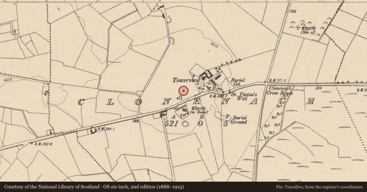
The record
- Townland
- Clonenagh
- County
- Laois
- Country
- Ireland
- First-edition OS map
- NULL
- Latest-edition OS map
- Not indicated
- Coordinates
- 53.01118, -7.42307
- SMR number
- LA017-003022-
Slide toward Today to fade the historical sheet and see the modern map underneath.
David Rumsey Map Collection, Stanford LibrariesDavid Rumsey Map Collection, Stanford LibrariesDavid Rumsey Map Collection, Stanford LibrariesDavid Rumsey Map Collection, Stanford Libraries
4 historical maps cover this location, the earliest the 1790 map "Composite: Ireland." (David Rumsey Map Collection, Stanford Libraries).
Historical maps covering this location
- 1790 · Composite: Ireland. (David Rumsey Map Collection, Stanford Libraries)
- 1811 · Ireland. (David Rumsey Map Collection, Stanford Libraries)
- 1869 · Ireland. (David Rumsey Map Collection, Stanford Libraries)
- 1891 · Ireland 16 (David Rumsey Map Collection, Stanford Libraries)
This record in the National Monuments Service's Historic Environment Viewer ↗
The National Monuments Service's description
In an elevated area. In 1988 thirteen early Christian cross-slabs, rectangular in shape were uncovered during the digging of a pathway through the graveyard (LA017-003007-) at Clonenagh. Three are in false relief, the remainder are simple incised crosses. These cross-slabs have been attached to the inner E face of the graveyard wall in the W quadrant of the graveyard.
The slabs have been numbered one to thirteen by Manning in his article entitled 'Cross-Slabs from Clonenagh, Co. Laois' (1998, 185-192). The slabs are upright just inside the gateway to the graveyard. This area has been used as a dumping place for cut grass and other debris that has resulted in the base of the slabs being covered in soil and vegetation.
Slab no 13 consists of a 'tiny cross is set in the ground within the burial plot of the Finn family, near the north-west corner of the graveyard. It is a plain Latin cross with dressed back portions on each face at each side of the shaft' (Manning 1998, 189).
Compiled by: Caimin O'Brien
Date of upload: 17 December 2007
Nearby in the register
- Cross-slabunder 1 mi
- Ecclesiastical enclosureunder 1 mi
- Churchunder 1 mi
- Graveyardunder 1 mi
Other entries of the same register within about three miles of this one, by straight line.