Sites and Monuments Record · Ireland
Bawn
Granny, County Kilkenny, Ireland
The record
- Townland
- Granny
- County
- Kilkenny
- Country
- Ireland
- First-edition OS map
- Indicated
- Latest-edition OS map
- Towers
- Coordinates
- 52.28078, -7.16075
- SMR number
- KK043-034008-
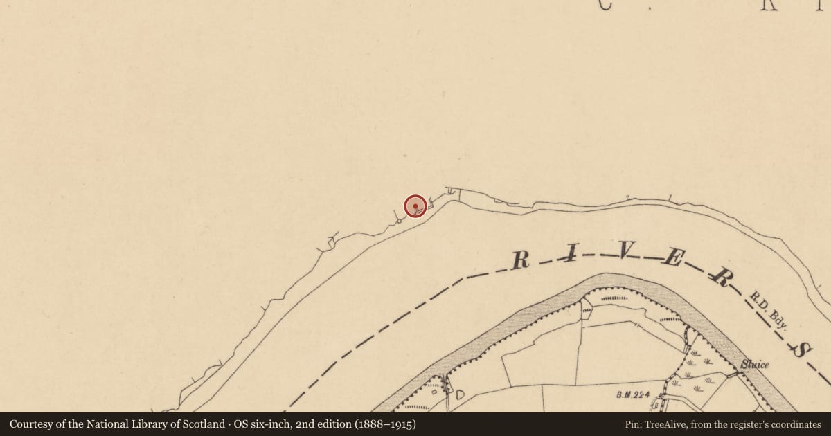
Slide toward Today to fade the historical sheet and see the modern map underneath.
David Rumsey Map Collection, Stanford LibrariesUniversity Library, Vrije Universiteit AmsterdamDavid Rumsey Map Collection, Stanford LibrariesDavid Rumsey Map Collection, Stanford Libraries
4 historical maps cover this location, the earliest the 1790 map "Composite: Ireland." (David Rumsey Map Collection, Stanford Libraries).
Historical maps covering this location
- 1790 · Composite: Ireland. (David Rumsey Map Collection, Stanford Libraries)
- 1882 · Ireland (southern half). (David Rumsey Map Collection, Stanford Libraries)
- 1891 · Ireland 16 (David Rumsey Map Collection, Stanford Libraries)
- 1911 · Sheet 14, 1911 (University Library, Vrije Universiteit Amsterdam)
This record in the National Monuments Service's Historic Environment Viewer ↗
The National Monuments Service's description
The castle, constructed of limestone rubble roughly coursed, consists of a square bawn (dims. 30m; wall T 2.2m) defended on the river side with a circular tower at the SE and SW angles, though only the foundations of the SE tower survive. The internal buildings including a NE tower, hall and SE tower (KK043-034001-) are located along the N wall of the bawn. The E bawn wall survives to a height of 3.8m. There is a further circular tower to the W, connected to the SW angle tower by a thin wall, which indicates that there was probably an outer bawn to the W. The bawn has a base-batter which is more pronounced along the S river side (H 3m; Wth c. 0.4m) than on the N and E sides (H 2m; Wth 0.3m), though it becomes more pronounced adjacent to the entrance in the E wall. The N and E bawn wall and the S wall of the NE angle tower were strengthened by a series of relieving arches (H 0.2-0.4m in E wall to 1.2m in N wall; Wth 0.87-2.13m, with an average Wth 1.33m) at the base of the wall, some quite pointed. Similar relieving arches were employed at the bawn of Ormond Castle. The buildings occupied the N wall of the bawn, with a rectangular tower house in the NE angle, a building with a circular tower at the NW angle and a hall between the two.
The SE angle tower of the bawn is almost complete gone, with only portion of the curving wall of the ground-floor surviving. It is depicted on Hooper’s 1791 sketch (Grose 1791, vol. 2, pl. 31), as a four-storey tower with a cross-loop at ground-floor level and single-light windows at each level in the SE, two at third-floor level. A chimney rises from above the parapet on the NW face. Within the S wall of the SE angle of the bawn there is a mural passage, lit by a loop in the S wall, to a double garderobe which suggests that, though now gone, there was an upper level with access to the garderobe chute.
The three-storey circular tower at the SW angle of the inner bawn is well preserved. It is accessed via a doorway (Wth 0.63m) at the S end of the W wall of the bawn. The ground floor is lit in the S, SW and SE faces by very fine, large cross-loops with stirrup bases, set into straight-sided depressed embrasures with plank-centring. At first-floor level there are windows in similar embrasures facing SSE and SW (blocked) and a fireplace in the E face. Second-floor level also has large embrasures, that in the S face has a depressed head with wicker centring, window replaced with brick and there is a wall cupboard in its W jamb. At the SW angle there is an ogee-headed single light window within a rectangular embrasure and facing W a loop in a rectangular angled embrasure. There is another light facing E. The narrow passage (L 4m), with wicker-centring, leading in from the bawn runs through the thickness of the wall (Wth 1m). It enters the tower at first-floor level, so must have been wooden ladder to drop down to ground floor level leading off passage to E is narrow angled mural passage lit by rectangular opes at E and W ends of S wall, and wicker roof with garderobe at E end. Leading off to W is a spiral staircase which accesses the second floor (Wth 0.9m). At third-floor level a doorway gives access to a mural passage in the S bawn wall leading to a small mural garderobe chamber. On Hooper’s sketch of 1791 this tower is shown with a gabled roof, perhaps orientated NW-SE, with a chimney at each apex. Another gabled roof is visible immediately N or NE of it, perhaps over the mural chamber.
Towards the W end of the S wall of the bawn, 5.48m from the SW angle, a rectangular doorway leads into small mural passage with wicker-centring and a wall cupboard in the N wall.
Mid-way along the W wall of the bawn there is a length of masonry (L 3.3m; T c. 1.5m) running internally c. 5m from, and at right angles to, the bawn. It is likely that this was part of the S wall of the building in the NW angle. A later wall, running from the inner face of the bawn wall and turning to connect with this length of masonry, has subsequently been added to create a small chamber, probably in the 18th or 19th century. The W bawn wall N of this has been replaced by a later wall (L 11.7m), as has the W end of the N wall of the bawn.
The circular tower on the SW angle of the outer bawn is not accessible internally. It has a substantial base-batter and is built on top of bedrock. Much of the E and W face are ivy covered and no features are visible. A stone wall continues westward from the W face for at least 2m.
Compiled by: Jean Farrelly
Date of upload: 20 April 2018
References
Grose, F. 1791 The antiquities of Ireland, 2 vols. London. S. Hooper.
Nearby in the register
- Castle - tower houseunder 1 mi
- Fulacht fiaunder 1 mi
- Structureunder 1 mi
- Excavation - miscellaneousunder 1 mi
Other entries of the same register within about three miles of this one, by straight line.