Sites and Monuments Record · Ireland
Megalithic tomb - wedge tomb
Boolyglass, County Kilkenny, Ireland
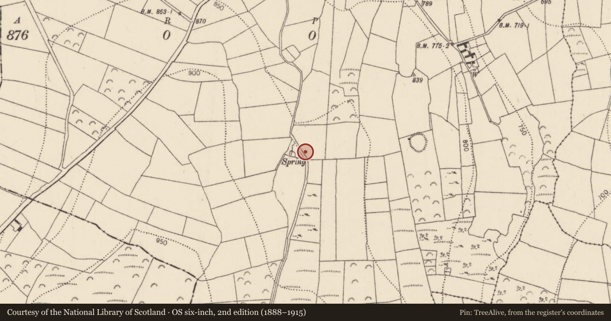
The record
- Townland
- Boolyglass
- County
- Kilkenny
- Country
- Ireland
- First-edition OS map
- Not indicated
- Latest-edition OS map
- Not indicated
- Coordinates
- 52.41888, -7.28203
- SMR number
- KK035-112----
Slide toward Today to fade the historical sheet and see the modern map underneath.
David Rumsey Map Collection, Stanford LibrariesDavid Rumsey Map Collection, Stanford LibrariesDavid Rumsey Map Collection, Stanford LibrariesDavid Rumsey Map Collection, Stanford Libraries
4 historical maps cover this location, the earliest the 1790 map "Composite: Ireland." (David Rumsey Map Collection, Stanford Libraries).
Historical maps covering this location
- 1790 · Composite: Ireland. (David Rumsey Map Collection, Stanford Libraries)
- 1869 · Ireland. (David Rumsey Map Collection, Stanford Libraries)
- 1882 · Ireland (southern half). (David Rumsey Map Collection, Stanford Libraries)
- 1891 · Ireland 16 (David Rumsey Map Collection, Stanford Libraries)
This record in the National Monuments Service's Historic Environment Viewer ↗
The National Monuments Service's description
In a shallow hollow on a broad shoulder of the N slope of Carricktriss hill. The W end of the monument is incorporated at an angle in a fence that runs along the N side of a farm lane. The remains comprise a gallery (L c. 5.1m), opening to the WNW. Its N side is composed of three stones and the S side of four stones; the W stone of the latter side is displaced and protrudes slightly through the fence where its base is visible. The E end of the gallery is closed by a backstone. This end is covered by a single roofstone which partly rests on a small orthostat that stands within the gallery just N of its S side. The exact function of this stone is uncertain. A second displaced roofstone lies on the S gallery wall that forms part of the fence. To the E of the backstone and in line with the gallery sides are two further orthostats which appear to indicate an end chamber (L c. 0.7m), open to the E. The S sidestone of this chamber is partly displaced and leans markedly inwards. Slight traces of a possible mound are visible to the N of the gallery and modern field clearance has been dumped against the fence at its SE end. Fogarty records that it was 'lately [dug] by gold dreamers. It was filled with black earth, charcoal, burned bones etc.' (Fogarty c. 1850, 85). (Ryan 1991, 883-4)
Compiled by: Paul Walsh
Date of upload: 10 May 2021
References
Fogarty, J. 1851-2 Account of antiquities in and around the barony of Iverk, Co. Kilkenny. Manuscript: Department of Irish Folklore, National University of Ireland, Dublin.
Ryan, J. 1991 Two ancient sites at Boolyglass, in south Co. Kilkenny. Old Kilkenny Review 4, 883-4.
Nearby in the register
- Enclosureunder 1 mi
- Ringfort - rathunder 1 mi
- Ringfort - rathunder 1 mi
- Moundunder 1 mi
Other entries of the same register within about three miles of this one, by straight line.