Sites and Monuments Record · Ireland
Ritual site - holy well
Castletown (Iverk By), County Kilkenny, Ireland
The record
- Townland
- Castletown (Iverk By)
- County
- Kilkenny
- Country
- Ireland
- First-edition OS map
- Not indicated
- Latest-edition OS map
- W
- Coordinates
- 52.39758, -7.37995
- SMR number
- KK034-032007-
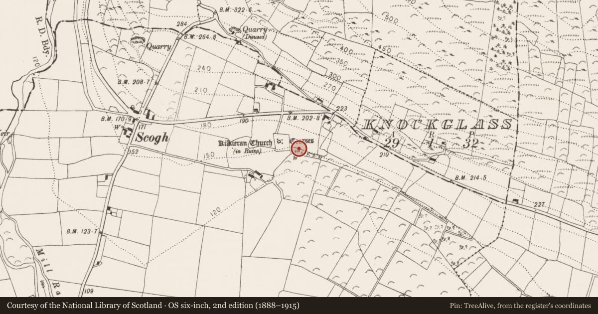
Slide toward Today to fade the historical sheet and see the modern map underneath.
David Rumsey Map Collection, Stanford LibrariesDavid Rumsey Map Collection, Stanford LibrariesDavid Rumsey Map Collection, Stanford LibrariesDavid Rumsey Map Collection, Stanford Libraries
4 historical maps cover this location, the earliest the 1790 map "Composite: Ireland." (David Rumsey Map Collection, Stanford Libraries).
Historical maps covering this location
- 1790 · Composite: Ireland. (David Rumsey Map Collection, Stanford Libraries)
- 1869 · Ireland. (David Rumsey Map Collection, Stanford Libraries)
- 1882 · Ireland (southern half). (David Rumsey Map Collection, Stanford Libraries)
- 1891 · Ireland 16 (David Rumsey Map Collection, Stanford Libraries)
This record in the National Monuments Service's Historic Environment Viewer ↗
The National Monuments Service's description
On the lower S-facing slope of Kilmacoliver Hill, overlooking the valley of the River Suir. The holy well is c. 25m E of the S side of Kilkeran graveyard (KK034-032002-). It is associated with the early medieval monastery of Kilkieran and Kilkieran church (KK034-032001-). The well is mentioned by Carrigan (1905, vol. 4, 243) as, ‘Tubber-Killkeerawin, or Kilkieran holy well’, he also refers to the ‘holy water font’ or bullaun (KK034-032008-) which is beside it. The stone-lined well is roughly circular in shape (dims. 0.82m N-S; 0.87m E-W; D 1.05m; D of water 0.36m), opening to the S where there are two large flat slab steps. The water springing from the well flows southward beneath the slabs. A roughly semi-circular area immediately to the N and E of the well has been revetted with curving stone walling. A concrete post has been erected to hold a long handled cup to enable pilgrims to drink from the well.
Compiled by: Jean Farrelly
Date of upload: 15 August 2018
References
Carrigan, Rev. W. 1905 (Reprint 1981) The history and antiquities of the diocese of Ossory, 4 vols. Kilkenny. Roberts Books and Wellbrook Press.
Nearby in the register
- Bullaun stoneunder 1 mi
- Bullaun stoneunder 1 mi
- Bullaun stoneunder 1 mi
- Standing stoneunder 1 mi
Other entries of the same register within about three miles of this one, by straight line.