Sites and Monuments Record · Ireland
Cross-inscribed pillar
Clonamery, County Kilkenny, Ireland
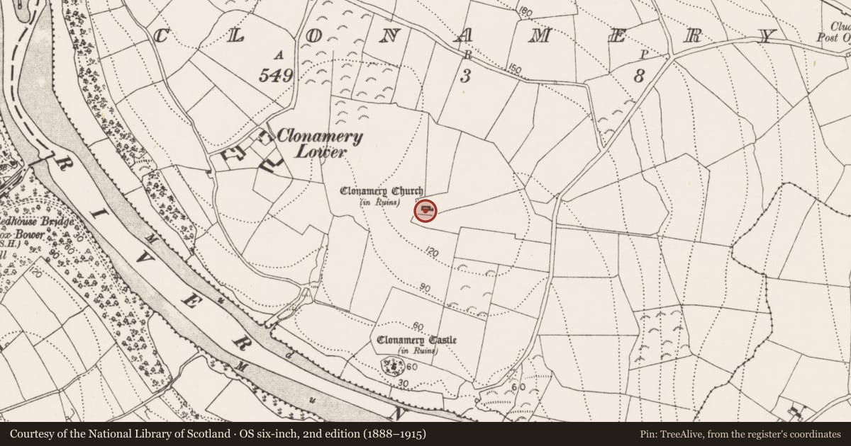
The record
- Townland
- Clonamery
- County
- Kilkenny
- Country
- Ireland
- First-edition OS map
- Not indicated
- Latest-edition OS map
- Not indicated
- Coordinates
- 52.46690, -7.03179
- SMR number
- KK033-021009-
Slide toward Today to fade the historical sheet and see the modern map underneath.
University Library, Vrije Universiteit AmsterdamUniversity Library, Vrije Universiteit AmsterdamDavid Rumsey Map Collection, Stanford LibrariesDavid Rumsey Map Collection, Stanford Libraries
4 historical maps cover this location, the earliest the 1790 map "Composite: Ireland." (David Rumsey Map Collection, Stanford Libraries).
Historical maps covering this location
- 1790 · Composite: Ireland. (David Rumsey Map Collection, Stanford Libraries)
- 1891 · Ireland 16 (David Rumsey Map Collection, Stanford Libraries)
- 1904 · Sheet 14, 1904 (University Library, Vrije Universiteit Amsterdam)
- 1911 · Sheet 14, 1911 (University Library, Vrije Universiteit Amsterdam)
This record in the National Monuments Service's Historic Environment Viewer ↗
The National Monuments Service's description
Currently resting in an upright position against the W gable of the nave, in the SW angle of the 10th/11th-century church of Clonamery (KK033-021001-). A granite pillar stone (L 1.12m; Wth at top 0.375; Wth at base 0.3m; T 0.085m) which is slightly wider at the rounded top. It is decorated with a simple equal-armed cross (H 0.25m; Wth 0.21m) which has been incised (D 0.02m) into the upper portion of the stone. There are two other cross-inscribed pillars in this church (KK033-021003-; KK033-021010-).
Compiled by: Jean Farrelly
Date of upload: 18 January 2017
Nearby in the register
- Architectural featureunder 1 mi
- Fontunder 1 mi
- Cross-inscribed pillarunder 1 mi
- Graveyardunder 1 mi
Other entries of the same register within about three miles of this one, by straight line.