Sites and Monuments Record · Ireland
Graveyard
Sheepstown, County Kilkenny, Ireland
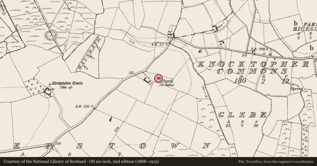
The record
- Townland
- Sheepstown
- County
- Kilkenny
- Country
- Ireland
- First-edition OS map
- Grave Yard
- Latest-edition OS map
- Indicated
- Coordinates
- 52.48487, -7.24340
- SMR number
- KK031-015002-
Slide toward Today to fade the historical sheet and see the modern map underneath.
David Rumsey Map Collection, Stanford LibrariesUniversity Library, Vrije Universiteit AmsterdamDavid Rumsey Map Collection, Stanford LibrariesDavid Rumsey Map Collection, Stanford Libraries
4 historical maps cover this location, the earliest the 1790 map "Composite: Ireland." (David Rumsey Map Collection, Stanford Libraries).
Historical maps covering this location
- 1790 · Composite: Ireland. (David Rumsey Map Collection, Stanford Libraries)
- 1869 · Ireland. (David Rumsey Map Collection, Stanford Libraries)
- 1891 · Ireland 16 (David Rumsey Map Collection, Stanford Libraries)
- 1911 · Sheet 14, 1911 (University Library, Vrije Universiteit Amsterdam)
This record in the National Monuments Service's Historic Environment Viewer ↗
The National Monuments Service's description
On a low rise with ground falling away in all directions, in undulating terrain, surrounded by pasture. A 12th-century church (KK031-015001-), aligned E-W, is located in the N half of the graveyard. The roughly circular graveyard (dims. c. 24m N-S; c. 26m E-W) is bounded by modern stone wall. The graveyard is itself surrounded by a slightly larger circular enclosure (KK031-015003-). According to Carrigan (1905, vol. 4, 9), the patron of the church is St. Muicin or Muicceen, whose festival was celebrated on the 4th March. There are seven headstones, including a pseudo-Celtic cross from 1954, which are all located in the graveyard to the S of the church. There date from the late 18th century, 19th and 20th centuries, with two burials added in 2007 and 2008 respectively to existing grave plots with 20th-century headstones. There are also a lot of small stones which have been used as grave-markers.
Compiled by: Jean Farrelly
Date of upload: 13 February 2017
References
Carrigan, Rev. W. 1905 (Reprint 1981) The history and antiquities of the diocese of Ossory, 4 vols. Kilkenny. Roberts Books and Wellbrook Press.
Nearby in the register
- Enclosureunder 1 mi
- Churchunder 1 mi
- Architectural fragmentunder 1 mi
- Excavation - miscellaneousunder 1 mi
Other entries of the same register within about three miles of this one, by straight line.