Sites and Monuments Record · Ireland
Moated site
Rossaneny (Reade), County Kilkenny, Ireland
The record
- Townland
- Rossaneny (Reade)
- County
- Kilkenny
- Country
- Ireland
- First-edition OS map
- Hachured
- Latest-edition OS map
- Not indicated
- Coordinates
- 52.46879, -7.39662
- SMR number
- KK030-014----
Slide toward Today to fade the historical sheet and see the modern map underneath.
David Rumsey Map Collection, Stanford LibrariesDavid Rumsey Map Collection, Stanford LibrariesDavid Rumsey Map Collection, Stanford LibrariesDavid Rumsey Map Collection, Stanford Libraries
4 historical maps cover this location, the earliest the 1790 map "Composite: Ireland." (David Rumsey Map Collection, Stanford Libraries).
Historical maps covering this location
- 1790 · Composite: Ireland. (David Rumsey Map Collection, Stanford Libraries)
- 1869 · Ireland. (David Rumsey Map Collection, Stanford Libraries)
- 1891 · Ireland 16 (David Rumsey Map Collection, Stanford Libraries)
- 1904 · Sheet 13. (David Rumsey Map Collection, Stanford Libraries)
This record in the National Monuments Service's Historic Environment Viewer ↗
The National Monuments Service's description
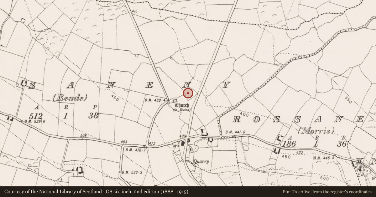
On a gentle N facing slope, located c. 46m NE of a medieval church (KK030-013001-) and graveyard (KK030-013002-). There is a possible moated site (KK030-015----) c. 290m to the NE. It is shown on the 1st (1839) ed. OS 6-inch map as a hachured subrectangular enclosure (dims. c. 55m NE-SW at SE end, narrowing to c. 30m at NW end; c. 54m NW-SE). which narrows towards the NW. When inspected in 1989 all but the narrow NW side, which is incorporated in an irregular field boundary, had been levelled. A stream, running along the line of a field boundary, appears to have run up to the E angle of the enclosure, possibly where there was a leat. This has been cut through by a public road, aligned roughly NNE-SSW, which runs immediately E of the E angle.
See attached:
KK030-014----_01 Extract from 1st (1839) ed. OS 6-inch map
KK030-014----_02 Satellite imagery (DigitalGlobe, imagery date 2011-2013)
KK030-014----_02 Satellite imagery (Google Earth, imagery date 4 September 2019)
Compiled by: Jean Farrelly
Date of upload: 9 August 2023
Nearby in the register
- Churchunder 1 mi
- Graveyardunder 1 mi
- Moated siteunder 1 mi
- Anomalous stone groupunder 1 mi
Other entries of the same register within about three miles of this one, by straight line.