Sites and Monuments Record · Ireland
Ecclesiastical enclosure
Killamery, County Kilkenny, Ireland
The record
- Townland
- Killamery
- County
- Kilkenny
- Country
- Ireland
- First-edition OS map
- Not indicated
- Latest-edition OS map
- Not indicated
- Coordinates
- 52.47520, -7.44557
- SMR number
- KK030-008002-
Slide toward Today to fade the historical sheet and see the modern map underneath.
David Rumsey Map Collection, Stanford LibrariesDavid Rumsey Map Collection, Stanford LibrariesDavid Rumsey Map Collection, Stanford LibrariesDavid Rumsey Map Collection, Stanford Libraries
4 historical maps cover this location, the earliest the 1790 map "Composite: Ireland." (David Rumsey Map Collection, Stanford Libraries).
Historical maps covering this location
- 1790 · Composite: Ireland. (David Rumsey Map Collection, Stanford Libraries)
- 1869 · Ireland. (David Rumsey Map Collection, Stanford Libraries)
- 1891 · Ireland 16 (David Rumsey Map Collection, Stanford Libraries)
- 1904 · Sheet 13. (David Rumsey Map Collection, Stanford Libraries)
This record in the National Monuments Service's Historic Environment Viewer ↗
The National Monuments Service's description
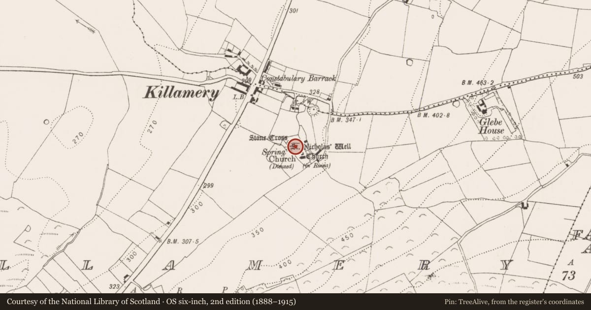
On raised ground at the base of a hill which rises to the S-SE, in rolling pasture overlooking a broad plain from NW-N. The land drops away steeply immediately N of the church where there is a small valley with St. Nicholas’s holy well (KK030-008007-) to the NW in this valley. The land rises again immediately N of this forming a hillock on which stands a high cross (KK030-008004-), the whole being encompassed by the graveyard (KK030-008010-). According to Carrigan (1905, vol. 4, 311-2) a monastery here was founded by St. Gobán Fionn early in the 7th century whose festival is celebrated on the 6th of December. The monastery would have been enclosed by a circular enclosure which is not currently visible at ground level. There is a curving scarp (L c. 40m) c. 13m N of the N wall of the graveyard which may be either an earlier graveyard boundary or could be portion of the ecclesiastical enclosure. The scarp terminates before reaching the field boundary to the E and this seems to be where a pathway, as indicated on the 1st (1839) ed. 6-inch OS map, ran from the S side of the village and entered the graveyard a the NE end of the N side.
Compiled by: Jean Farrelly
Date of upload: 8 August 2017
References
Carrigan, Rev. W. 1905 (Reprint 1981) The history and antiquities of the diocese of Ossory, 4 vols. Kilkenny. Roberts Books and Wellbrook Press.
Nearby in the register
- Graveyardunder 1 mi
- Cross-slabunder 1 mi
- Cross-slabunder 1 mi
- Churchunder 1 mi
Other entries of the same register within about three miles of this one, by straight line.