Sites and Monuments Record · Ireland
Church
Ballylinch Demesne, County Kilkenny, Ireland
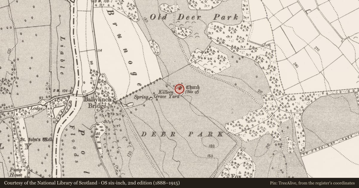
The record
- Townland
- Ballylinch Demesne
- County
- Kilkenny
- Country
- Ireland
- First-edition OS map
- (Site of) Church
- Latest-edition OS map
- Church (Site of)
- Coordinates
- 52.54215, -7.18723
- SMR number
- KK028-018001-
Slide toward Today to fade the historical sheet and see the modern map underneath.
David Rumsey Map Collection, Stanford LibrariesUniversity Library, Vrije Universiteit AmsterdamDavid Rumsey Map Collection, Stanford LibrariesDavid Rumsey Map Collection, Stanford Libraries
4 historical maps cover this location, the earliest the 1790 map "Composite: Ireland." (David Rumsey Map Collection, Stanford Libraries).
Historical maps covering this location
- 1790 · Composite: Ireland. (David Rumsey Map Collection, Stanford Libraries)
- 1869 · Ireland. (David Rumsey Map Collection, Stanford Libraries)
- 1891 · Ireland 16 (David Rumsey Map Collection, Stanford Libraries)
- 1911 · Sheet 14, 1911 (University Library, Vrije Universiteit Amsterdam)
This record in the National Monuments Service's Historic Environment Viewer ↗
The National Monuments Service's description
The church is indicated as a building in the NE sector of the Killeen graveyard (KK028-018002-) on the 1st (1839) ed. OS 6-inch map and is indicated by a cross ‘Site of’ immediately S of the NW wall of the shrunken graveyard on the 1948-9 revision of the OS 6-inch map. According to the OS letters (1839), the graveyard, ‘called Killeen or the Little Kill in Ballylinch (Lord Carrick’s) Demesne (O'Flanagan 1930, vol. 2, 268 (88)). This place was for the exclusive use of the Carrick family and contained a small Church which is now gone to ruin’. Carrigan (1905, vol. 4, 269) describes the ‘ancient churchyard’ of Ballylinch which contains, ‘the mortuary chapel of the Carrick family, and some head-stones marking the graves of old Catholic families of the neighbourhood. There are no remains of the church’.
Compiled by: Jean Farrelly
References
Carrigan, Rev. W. 1905 (Reprint 1981) The history and antiquities of the diocese of Ossory, 4 vols. Kilkenny. Roberts Books and Wellbrook Press. O'Flanagan, Rev. M. (Compiler) 1930 Letters containing information relative to the antiquities of the county of Kilkenny collected during the progress of the Ordnance Survey in 1839. Bray.
Nearby in the register
- Graveyardunder 1 mi
- Enclosureunder 1 mi
- Castle - unclassifiedunder 1 mi
- House - 16th/17th centuryunder 1 mi
Other entries of the same register within about three miles of this one, by straight line.