Sites and Monuments Record · Ireland
Graveslab
Rathduff (Madden), County Kilkenny, Ireland
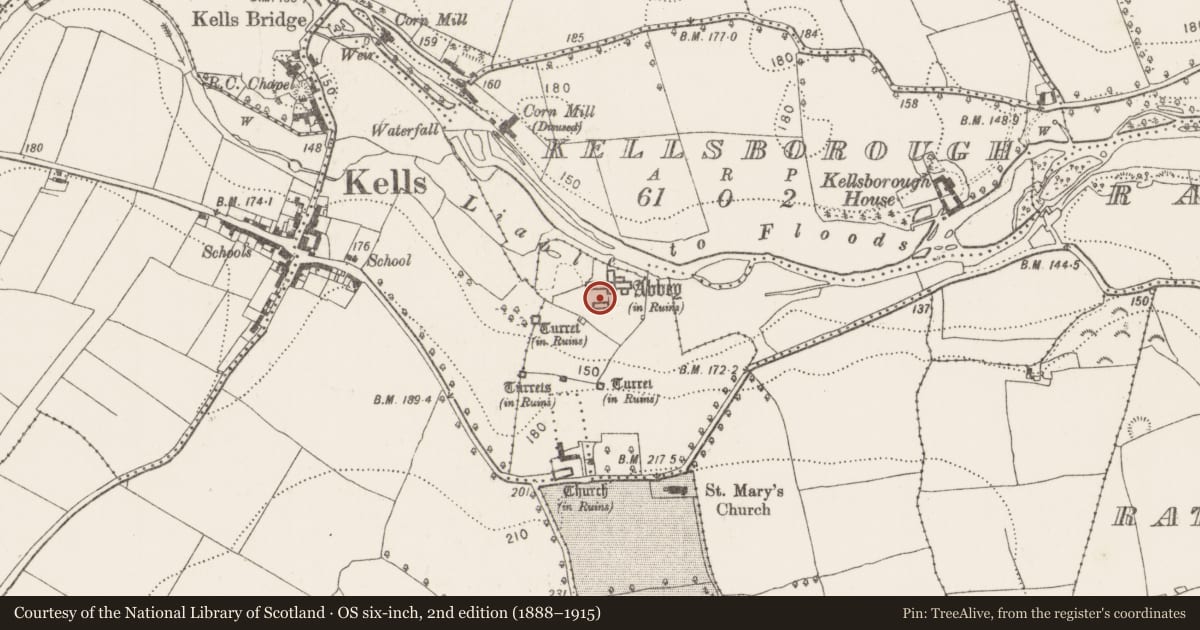
The record
- Townland
- Rathduff (Madden)
- County
- Kilkenny
- Country
- Ireland
- First-edition OS map
- Not indicated
- Latest-edition OS map
- Not indicated
- Coordinates
- 52.53893, -7.26663
- SMR number
- KK027-029031-
Slide toward Today to fade the historical sheet and see the modern map underneath.
David Rumsey Map Collection, Stanford LibrariesDavid Rumsey Map Collection, Stanford LibrariesDavid Rumsey Map Collection, Stanford LibrariesDavid Rumsey Map Collection, Stanford Libraries
4 historical maps cover this location, the earliest the 1790 map "Composite: Ireland." (David Rumsey Map Collection, Stanford Libraries).
Historical maps covering this location
- 1790 · Composite: Ireland. (David Rumsey Map Collection, Stanford Libraries)
- 1869 · Ireland. (David Rumsey Map Collection, Stanford Libraries)
- 1882 · Ireland (southern half). (David Rumsey Map Collection, Stanford Libraries)
- 1891 · Ireland 16 (David Rumsey Map Collection, Stanford Libraries)
This record in the National Monuments Service's Historic Environment Viewer ↗
The National Monuments Service's description
One of a large number of graveslabs (KK027-029005-; KK027-029015-, KK027-029016-, KK027-029021- to KK027-029051-) found at Kells Priory for Augustinian canons (KK027-029004-) which have been described and catalogued by Higgins (2007, 453-67).
A tapering slab (L 1.815m; Wth at top 0.66m; Wth at base 0.395m; T 0.17m) with beveled edges. It is decorated with an incised two-lined open lozenge-shaped cross-head with concave sides and fleur-de-lis terminals. There is a circular knop on the cross-shaft immediately below the cross-head. The cross-shaft terminates with a fleur-de-lis with a circular knop immediately above it. Stylistically the graveslab dates to the 13th/14th century. (Higgins 2007, cat. no. 14, 460, fig. 7.2:1).
Ref.:
Higgins, J. 2007 The medieval funerary monuments. In M. Clyne, (ed.), Kells Priory, Co. Kilkenny: archaeological excavations by T. Fanning & M. Clyne, 453-67. Department of Environment, Heritage and Local Government. Dublin.
See attached:
KK027-029031-_01 Illustration in Higgins, J. 2007 The medieval funerary monuments. In M. Clyne, (ed.), Kells Priory, Co. Kilkenny: archaeological excavations by T. Fanning & M. Clyne, 453-67.
Compiled by: Jean Farrelly
Date of upload: 31 May 2023
References
Clyne, M. 2007 Kells Priory, Co. Kilkenny: archaeological excavations by T. Fanning & M. Clyne. Department of Environment, Heritage and Local Government. Dublin.
Nearby in the register
Other entries of the same register within about three miles of this one, by straight line.