Sites and Monuments Record · Ireland
Castle - tower house
Callan South, County Kilkenny, Ireland
The record
- Townland
- Callan South
- County
- Kilkenny
- Country
- Ireland
- First-edition OS map
- Not indicated
- Latest-edition OS map
- Not indicated
- Coordinates
- 52.54469, -7.39030
- SMR number
- KK026-010003-
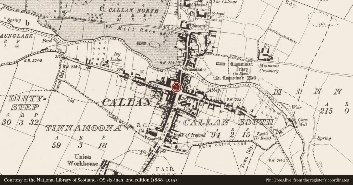
Slide toward Today to fade the historical sheet and see the modern map underneath.
David Rumsey Map Collection, Stanford LibrariesDavid Rumsey Map Collection, Stanford LibrariesDavid Rumsey Map Collection, Stanford LibrariesDavid Rumsey Map Collection, Stanford Libraries
4 historical maps cover this location, the earliest the 1790 map "Composite: Ireland." (David Rumsey Map Collection, Stanford Libraries).
Historical maps covering this location
- 1790 · Composite: Ireland. (David Rumsey Map Collection, Stanford Libraries)
- 1869 · Ireland. (David Rumsey Map Collection, Stanford Libraries)
- 1891 · Ireland 16 (David Rumsey Map Collection, Stanford Libraries)
- 1904 · Sheet 13. (David Rumsey Map Collection, Stanford Libraries)
This record in the National Monuments Service's Historic Environment Viewer ↗
The National Monuments Service's description
Carrigan (1905, vol. 3, 292-3) mentions several castles in Callan, though these are difficult to precisely locate. According to Carrigan (ibid. 293), ‘Upon and inside it [Callan] there were several castles. One of these stood on the site now occupied by Mrs. Meany's Grocery and Spirit Establishment; another at the opposite corner of the street, in Mr. James Pollard’s yard’. This suggests that the castle (KK026-010003-) occupied by Meany’s c. 1900 and the castle (KK026-010004-) opposite it, is at the crossroads in the centre of town, one possibly occupying the NW angle and the other located in a yard in the opposite SW angle (Farrelly et al. 1993, vol. 1, 114-15; vol. 2, map 7:3).
A two-storey hipped-roof building currently occupies the NW angle, presenting three bays on West Street and two bays on Bridge Street, with a shop at ground level. It is possible that the current building incorporates medieval fabric.
Compiled by: Jean Farrelly
Date of upload: 8 June 2022
References
Farrelly, J., O'Reilly, B., and Loughran, A. 1993 Urban archaeological survey - county Kilkenny (2 vols.). Unpublished report commissioned by the Office of Public Works, Dublin.
Carrigan, Rev. W. 1905 (Reprint 1981) The history and antiquities of the diocese of Ossory, 4 vols. Kilkenny. Roberts Books and Wellbrook Press.
Nearby in the register
- Cross - Market crossunder 1 mi
- Castle - tower houseunder 1 mi
- Castle - tower houseunder 1 mi
- Graveslabunder 1 mi
Other entries of the same register within about three miles of this one, by straight line.