Sites and Monuments Record · Ireland
Water mill - unclassified
Bennettsbridge (Shillelogher By.), County Kilkenny, Ireland
The record
- Townland
- Bennettsbridge (Shillelogher By.)
- County
- Kilkenny
- Country
- Ireland
- First-edition OS map
- Flour Mill
- Latest-edition OS map
- Corn Mill
- Coordinates
- 52.58958, -7.18535
- SMR number
- KK024-033----
Slide toward Today to fade the historical sheet and see the modern map underneath.
David Rumsey Map Collection, Stanford LibrariesUniversity Library, Vrije Universiteit AmsterdamDavid Rumsey Map Collection, Stanford LibrariesDavid Rumsey Map Collection, Stanford Libraries
4 historical maps cover this location, the earliest the 1790 map "Composite: Ireland." (David Rumsey Map Collection, Stanford Libraries).
Historical maps covering this location
- 1790 · Composite: Ireland. (David Rumsey Map Collection, Stanford Libraries)
- 1869 · Ireland. (David Rumsey Map Collection, Stanford Libraries)
- 1891 · Ireland 16 (David Rumsey Map Collection, Stanford Libraries)
- 1911 · Sheet 14, 1911 (University Library, Vrije Universiteit Amsterdam)
This record in the National Monuments Service's Historic Environment Viewer ↗
The National Monuments Service's description
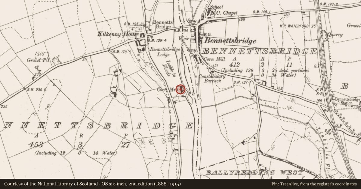
A mill is indicated roughly at this location on the Down Survey (1655-6) barony map of Sheelogher/‘Sheelelogher’ (Hibernia Regnum, courtesy of Trinity College Dublin). Carrigan (1905, vol. 3, 487) noted that in 1794, 'the tourist Holmes observed at Bennetsbrige, "near the river a small ancient building, now part of a mill". There is a watermill on the W bank of the River Nore indicated as 'Flour Mill' on the 1st (1839) ed. OS 6-inch map which may be on the location of the Down Survey mill. It is shown as a 'Corn Mill' on the 1899-1902 revision of the OS 6-inch map. The building is currently used to produce and sell locally made pottery.
See attached:
KK024-033----_01 extract from the Down Survey (1655-6) barony map of Sheelogher/‘Sheelelogher’ (Hibernia Regnum, courtesy of Trinity College Dublin)
Compiled by: Jean Farrelly
Date of upload: 27 September 2021
References
Carrigan, Rev. W. 1905 (Reprint 1981) The history and antiquities of the diocese of Ossory, 4 vols. Kilkenny. Roberts Books and Wellbrook Press.
Nearby in the register
- Bridgeunder 1 mi
- Chapelunder 1 mi
- Ring-ditchunder 1 mi
- Ring-ditchunder 1 mi
Other entries of the same register within about three miles of this one, by straight line.