Sites and Monuments Record · Ireland
Enclosure
Dunbell Big, County Kilkenny, Ireland
The record
- Townland
- Dunbell Big
- County
- Kilkenny
- Country
- Ireland
- First-edition OS map
- Not indicated
- Latest-edition OS map
- Not indicated
- Coordinates
- 52.61091, -7.17735
- SMR number
- KK024-015----
Slide toward Today to fade the historical sheet and see the modern map underneath.
David Rumsey Map Collection, Stanford LibrariesUniversity Library, Vrije Universiteit AmsterdamDavid Rumsey Map Collection, Stanford LibrariesDavid Rumsey Map Collection, Stanford Libraries
4 historical maps cover this location, the earliest the 1790 map "Composite: Ireland." (David Rumsey Map Collection, Stanford Libraries).
Historical maps covering this location
- 1790 · Composite: Ireland. (David Rumsey Map Collection, Stanford Libraries)
- 1869 · Ireland. (David Rumsey Map Collection, Stanford Libraries)
- 1891 · Ireland 16 (David Rumsey Map Collection, Stanford Libraries)
- 1911 · Sheet 14, 1911 (University Library, Vrije Universiteit Amsterdam)
This record in the National Monuments Service's Historic Environment Viewer ↗
The National Monuments Service's description
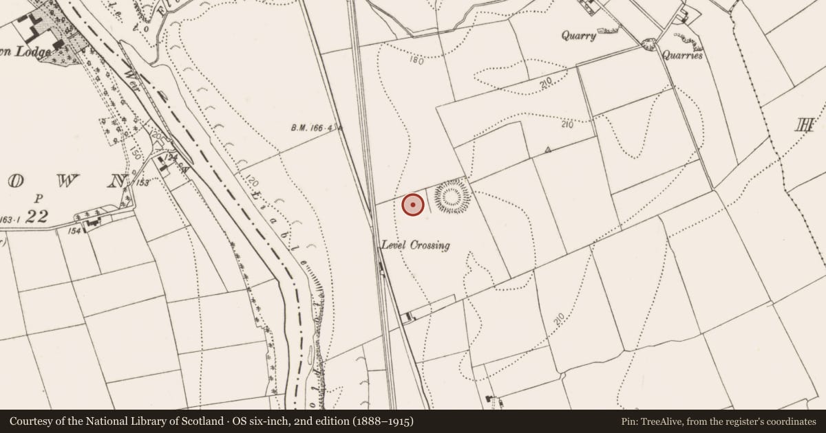
In the 19th century a number of the enclosures in Dunbell Big were excavated (Prim 1852-3, 119-27; 1853-5, 397-408). Prim (1872-3, 225) produced a map titled, ‘Map showing position of raths at Dunbel, Co. Kilkenny’ indicating enclosures in Dunbell Big. A multivallate ringfort (KK024-016----) is indicated as ‘E’, with a univallate enclosure, indicated as ‘F’ in the field immediately to the W and c. 30m W of the multivallate ringfort. Prim’s map includes some enclosure which are indicated on the 1st (1840) ed. OS 6-inch map and excludes others, however, the map does appear to be drawn accurately which suggests that there was an upstanding enclosure at this location. This univallate enclosure is not indicated on the 1st (1840) or subsequent (1899-1902) ed. OS 6-inch map, nor is it visible on satellite imagery. Another enclosure (KK024-018----) is indicated on the 1st ed. OS 6-inch map c. 250m to the SW.
See attached:
KK024-015---- Prim's map of 1872-3, 225
Compiled by: Jean Farrelly
Date of upload: 10 November 2021
References
Prim, J.G.A. 1852-3 Excavation of a rath at Dunbel, County of Kilkenny. Journal of the Royal Society of Antiquarians of Ireland 2, 119-27.
Prim, J.G.A. 1853-5 On the discovery of ogham monuments and other antiquities in the raths of Dunbel, County of Kilkenny. Journal of the Royal Society of Antiquarians of Ireland 3, 397-408.
Prim, J.G.A. 1872-3 The ogham monuments of Kilkenny, being a letter from Samuel Ferguson, Esq. Journal of the Royal Society of Antiquarians of Ireland 12, 222-38.
Nearby in the register
- Ringfort - rathunder 1 mi
- Enclosureunder 1 mi
- Field systemunder 1 mi
- Enclosureunder 1 mi
Other entries of the same register within about three miles of this one, by straight line.