Sites and Monuments Record · Ireland
Cist
Dunbell Big, County Kilkenny, Ireland
The record
- Townland
- Dunbell Big
- County
- Kilkenny
- Country
- Ireland
- First-edition OS map
- Not indicated
- Latest-edition OS map
- Not indicated
- Coordinates
- 52.61804, -7.17806
- SMR number
- KK024-010008-
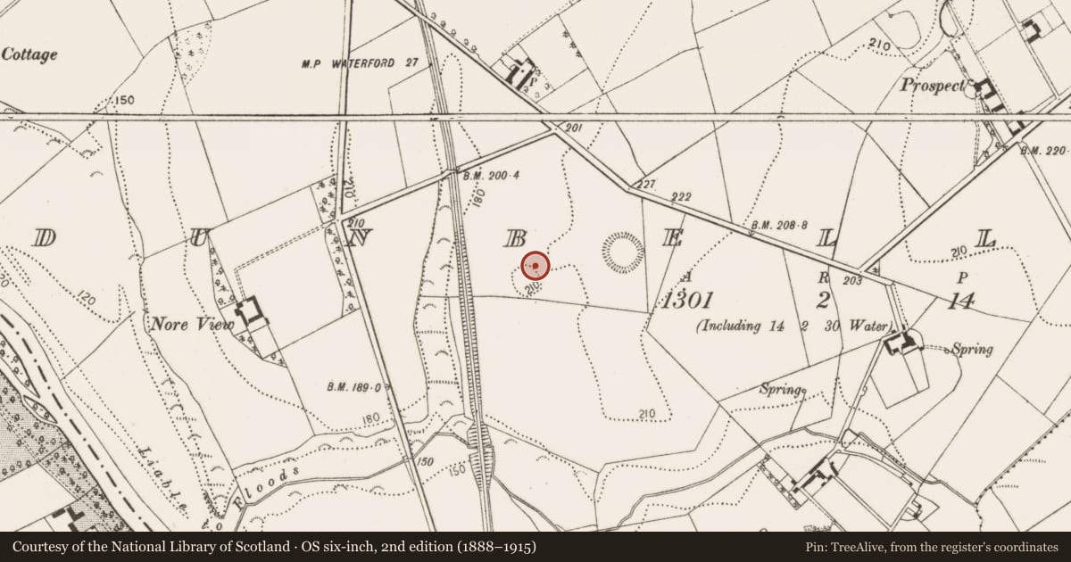
Slide toward Today to fade the historical sheet and see the modern map underneath.
David Rumsey Map Collection, Stanford LibrariesUniversity Library, Vrije Universiteit AmsterdamDavid Rumsey Map Collection, Stanford LibrariesDavid Rumsey Map Collection, Stanford Libraries
4 historical maps cover this location, the earliest the 1790 map "Composite: Ireland." (David Rumsey Map Collection, Stanford Libraries).
Historical maps covering this location
- 1790 · Composite: Ireland. (David Rumsey Map Collection, Stanford Libraries)
- 1869 · Ireland. (David Rumsey Map Collection, Stanford Libraries)
- 1891 · Ireland 16 (David Rumsey Map Collection, Stanford Libraries)
- 1911 · Sheet 14, 1911 (University Library, Vrije Universiteit Amsterdam)
This record in the National Monuments Service's Historic Environment Viewer ↗
The National Monuments Service's description
Between September 1990 and January 1991 remote sensing and trial trenching was carried out at a ringfort (KK024-010001-) in Dunbell Big (Cassidy 1990, 38-9; Cassidy 1991, 18-20). A pit-burial (KK024-010005-) with crushed food vessel was uncovered 0.4m to the N of the cist burial, under the foundations of an early medieval house (KK024-010006-) (ibid.). The cist burial is described by Cassidy (1991, 20) as being, ‘contained in a well-built cist sealed with two capstones. The cist fill was mainly a reddish loam and lying at its base was an intact Food Vessel containing and surrounded by burnt bone. This Food Vessel may belong to a slightly more recent era than the crushed one and had relatively simple incised decoration’, suggesting a date range of 2000-1500 BC.
Compiled by: Jean Farrelly
Date of upload: 9 November 2021
References
Cassidy, B. 1991 Dunbell ringfort No. 5, Dunbell Big. In I. Bennett (ed.), Excavations 1990: summary accounts of excavations in Ireland, 38-9. Bray. Wordwell.
Cassidy, B. 1991 Digging at Dunbell Big. Archaeology Ireland 5, no. 2, 18-20.
Nearby in the register
- Ringfort - rathunder 1 mi
- Souterrainunder 1 mi
- Ogham stoneunder 1 mi
- Ogham stoneunder 1 mi
Other entries of the same register within about three miles of this one, by straight line.