Sites and Monuments Record · Ireland
Ritual site - holy well
Burnchurch, County Kilkenny, Ireland
The record
- Townland
- Burnchurch
- County
- Kilkenny
- Country
- Ireland
- First-edition OS map
- Not indicated
- Latest-edition OS map
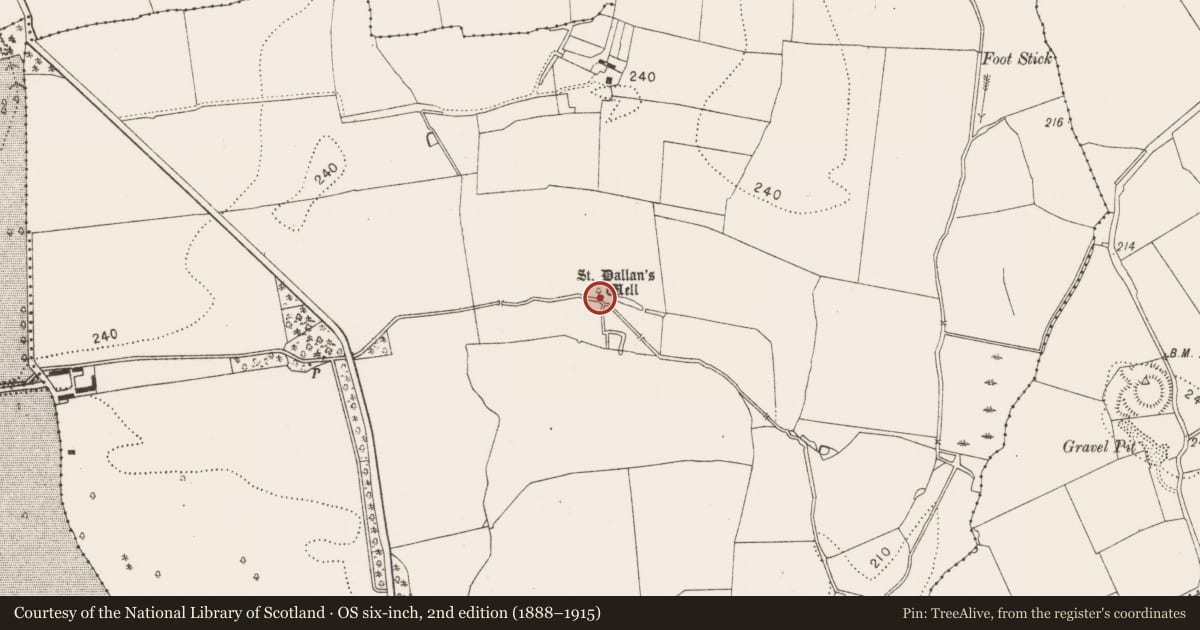
- St. Dallans Well
- Coordinates
- 52.58439, -7.29304
- SMR number
- KK023-054----
Slide toward Today to fade the historical sheet and see the modern map underneath.
David Rumsey Map Collection, Stanford LibrariesDavid Rumsey Map Collection, Stanford LibrariesDavid Rumsey Map Collection, Stanford LibrariesDavid Rumsey Map Collection, Stanford Libraries
4 historical maps cover this location, the earliest the 1790 map "Composite: Ireland." (David Rumsey Map Collection, Stanford Libraries).
Historical maps covering this location
- 1790 · Composite: Ireland. (David Rumsey Map Collection, Stanford Libraries)
- 1868 · 4. Ireland. (David Rumsey Map Collection, Stanford Libraries)
- 1869 · Ireland. (David Rumsey Map Collection, Stanford Libraries)
- 1891 · Ireland 16 (David Rumsey Map Collection, Stanford Libraries)
This record in the National Monuments Service's Historic Environment Viewer ↗
The National Monuments Service's description
Indicated on the 1947 revision OS 6-inch map as 'St. Dallan's Well', this is the present location of the holy well which was originally c. 40m to the S (see KK023-053003-). According to Carrigan (1905, vol. 3, 376), 'the well was removed to its present position by the Flood family. The old basin, however, remains uninjured, about 40 yds. to the north [actually to the S], beside the fosse of a small square rath [KK023-100----]. A drain conveys the water, underground, from the old well to the new one. A pattern was held at the well on the first Sunday of August, till the early part of the 19th century, but tradition says that the people attended it were divided as to whether the real pattern day, that is, the feast day of the saint, was the first day of August or the third'.
Compiled by: Jean Farrelly
Date of upload: 17 August 2021
References
Carrigan, Rev. W. 1905 (Reprint 1981) The history and antiquities of the diocese of Ossory, 4 vols. Kilkenny. Roberts Books and Wellbrook Press.
Nearby in the register
- Ritual site - holy wellunder 1 mi
- Enclosureunder 1 mi
- Graveyardunder 1 mi
- Churchunder 1 mi
Other entries of the same register within about three miles of this one, by straight line.