Sites and Monuments Record · Ireland
Graveyard
Kilmog Or Racecourse, County Kilkenny, Ireland
The record
- Townland
- Kilmog Or Racecourse
- County
- Kilkenny
- Country
- Ireland
- First-edition OS map
- Not indicated
- Latest-edition OS map
- Not indicated
- Coordinates
- 52.60863, -7.26564
- SMR number
- KK023-009004-
Slide toward Today to fade the historical sheet and see the modern map underneath.
David Rumsey Map Collection, Stanford LibrariesDavid Rumsey Map Collection, Stanford LibrariesDavid Rumsey Map Collection, Stanford LibrariesDavid Rumsey Map Collection, Stanford Libraries
4 historical maps cover this location, the earliest the 1790 map "Composite: Ireland." (David Rumsey Map Collection, Stanford Libraries).
Historical maps covering this location
- 1790 · Composite: Ireland. (David Rumsey Map Collection, Stanford Libraries)
- 1868 · 4. Ireland. (David Rumsey Map Collection, Stanford Libraries)
- 1869 · Ireland. (David Rumsey Map Collection, Stanford Libraries)
- 1891 · Ireland 16 (David Rumsey Map Collection, Stanford Libraries)
This record in the National Monuments Service's Historic Environment Viewer ↗
The National Monuments Service's description
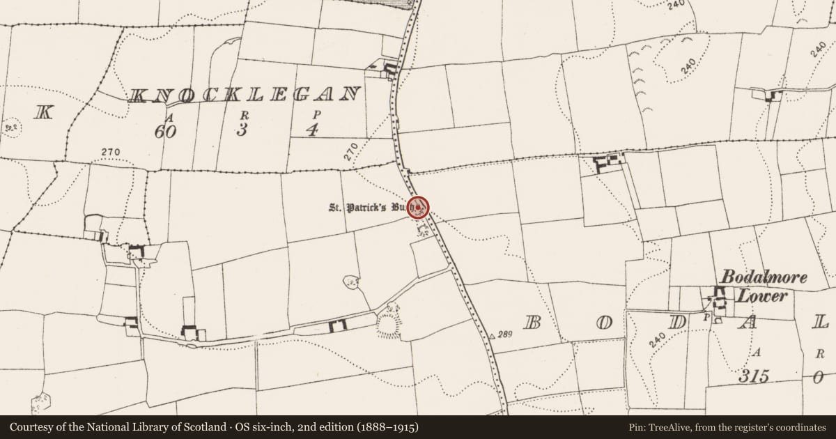
Carrigan (1905, vol. 3, 390, 392) citing O'Donovan (OS Letters, 1839) gives the translation of the Irish name for the townland, Kilmogga, as, 'the Church of St. Magadh' and he gives a reference to a 13th-century charter which mentions the church (KK023-009003-) at Kilmog. Carrigan (ibid. 392-3) gives the location of the church and graveyard as, 'A gravel pit, a perch or two [5-10m] to the rere of the Bush [holy tree KK023-009002-] and Rock [bullaun stone KK023-009001-], marks, according to tradition, the site of an obliterated "churchyard." Here, then, must have stood the ancient church of St. Magadh, from which the townland of Kilmogg has been named'. The gravel pit is indicated on the 1st (1839) ed. OS 6-inch map, and on the 1947 revision, in the field immediately S of 'St. Patrick's Bush', running along the roadside. There is no visible trace of the graveyard at ground level.
Compiled by: Jean Farrelly
Date of upload: 1 June 2021
References
Carrigan, Rev. W. 1905 (Reprint 1981) The history and antiquities of the diocese of Ossory, 4 vols. Kilkenny. Roberts Books and Wellbrook Press.
Nearby in the register
- Bullaun stoneunder 1 mi
- Ritual site - holy tree/bushunder 1 mi
- Churchunder 1 mi
- Enclosureunder 1 mi
Other entries of the same register within about three miles of this one, by straight line.