Sites and Monuments Record · Ireland
Ecclesiastical enclosure
Greatwood, County Kilkenny, Ireland
The record
- Townland
- Greatwood
- County
- Kilkenny
- Country
- Ireland
- First-edition OS map
- Not indicated
- Latest-edition OS map
- Hachured
- Coordinates
- 52.58514, -7.36429
- SMR number
- KK022-019002-
Slide toward Today to fade the historical sheet and see the modern map underneath.
David Rumsey Map Collection, Stanford LibrariesDavid Rumsey Map Collection, Stanford LibrariesDavid Rumsey Map Collection, Stanford LibrariesDavid Rumsey Map Collection, Stanford Libraries
4 historical maps cover this location, the earliest the 1790 map "Composite: Ireland." (David Rumsey Map Collection, Stanford Libraries).
Historical maps covering this location
- 1790 · Composite: Ireland. (David Rumsey Map Collection, Stanford Libraries)
- 1869 · Ireland. (David Rumsey Map Collection, Stanford Libraries)
- 1882 · Ireland (southern half). (David Rumsey Map Collection, Stanford Libraries)
- 1891 · Ireland 16 (David Rumsey Map Collection, Stanford Libraries)
This record in the National Monuments Service's Historic Environment Viewer ↗
The National Monuments Service's description
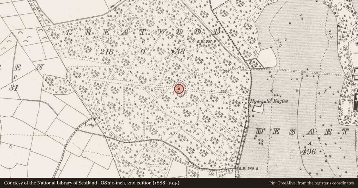
In woodland, indicated as a raised oval area (dims. c. 74m N-S; c. 52m E-W) on the 1899-1900 revision of the 6-inch OS map. The map shows the wood crisscrossed with trackways, including a wider main track running roughly E-W through the centre of the enclosure. Another track, running roughly NE-SW, skirts along the NW sector, and has subsequently become a public road. According to Carrigan (1905, vol. 3, 441), in Greatwood townland, 'there is a field called the Bawnakilleen, that is, the field of the Killeen or little church. Tradition states that there was an ancient church here, and that a small circular enclosure, like a rath, still remaining, marks the place in which it stood'. The enclosure is heavily overgrown with trees and scrub, surrounded by intensively planted woodland. The church (KK022-019001-) is not indicated on the 1st (1839) or revised (1899-1900) ed. of the OS 6-inch map.
Compiled by: Jean Farrelly
Date of upload: 24 May 2021
References
Carrigan, Rev. W. 1905 (Reprint 1981) The history and antiquities of the diocese of Ossory, 4 vols. Kilkenny. Roberts Books and Wellbrook Press.
Nearby in the register
- Churchunder 1 mi
- Enclosure - large enclosureunder 1 mi
- Churchunder 1 mi
- Graveyardunder 1 mi
Other entries of the same register within about three miles of this one, by straight line.