Sites and Monuments Record · Ireland
Ecclesiastical enclosure
Kilbraghan (Crannagh By.), County Kilkenny, Ireland
The record
- Townland
- Kilbraghan (Crannagh By.)
- County
- Kilkenny
- Country
- Ireland
- First-edition OS map
- Not indicated
- Latest-edition OS map
- Not indicated
- Coordinates
- 52.59352, -7.45951
- SMR number
- KK022-011003-
Slide toward Today to fade the historical sheet and see the modern map underneath.
David Rumsey Map Collection, Stanford LibrariesDavid Rumsey Map Collection, Stanford LibrariesDavid Rumsey Map Collection, Stanford LibrariesDavid Rumsey Map Collection, Stanford Libraries
4 historical maps cover this location, the earliest the 1790 map "Composite: Ireland." (David Rumsey Map Collection, Stanford Libraries).
Historical maps covering this location
- 1790 · Composite: Ireland. (David Rumsey Map Collection, Stanford Libraries)
- 1869 · Ireland. (David Rumsey Map Collection, Stanford Libraries)
- 1891 · Ireland 16 (David Rumsey Map Collection, Stanford Libraries)
- 1904 · Sheet 13. (David Rumsey Map Collection, Stanford Libraries)
This record in the National Monuments Service's Historic Environment Viewer ↗
The National Monuments Service's description
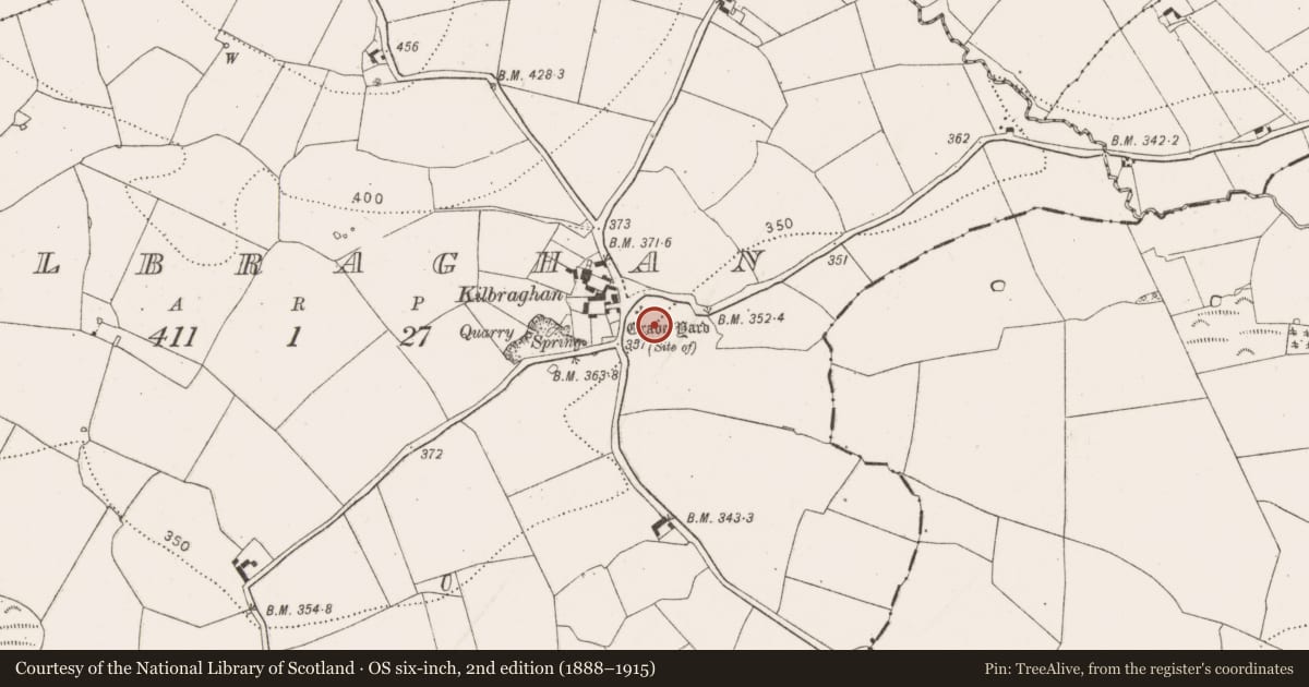
According to Holahan (1883, 107), 'There was formerly a graveyard [KK022-011002-] in Kilbrahan. Its site is still pointed out at the cross-roads, in a field, at the left, as one approaches the village from Graigue. When the field was tilled at the beginning of this [19th] century, portions of coffins and human bones were found there. According to local tradition, there was a church [KK022-011001-] here also; but no traces of it now remain. The church was dedicated to St. Braghan, from whom the place derives its name. His feast is set down in the Martyrology of Donegal on the 17th of September'. Carrigan (1905, vol. 3, 442) notes that, 'St. Brachan's church at Kilbraghan cross, at the exact point where the public road branches off to Graigue...was thrown down, and the graveyard destroyed, many years ago, when this road was being constructed. It is said that there was a monastery here in ancient times'. The curving of the Graigue road may follow the N arc of an ecclesiastical enclosure (diam. c. 90-100m) (Swan 1987 unpublished notes). There is no visible trace of the enclosure to the E-S-SW.
Compiled by: Jean Farrelly
Date of upload: 17 May 2021
References
Carrigan, Rev. W. 1905 (Reprint 1981) The history and antiquities of the diocese of Ossory, 4 vols. Kilkenny. Roberts Books and Wellbrook Press.
Holahan, Rev. J. 1883 Notes on the antiquities of the united parishes of Ballycallan, Kilmanagh and Killaloe. Transactions of the Ossory Archaeological Society 3, part 1, 81-122.
Swan, L. 1987 Notes. Unpublished. Incorporated into the Sites and Monuments Records files, National Monuments Service.
Nearby in the register
- Churchunder 1 mi
- Graveyardunder 1 mi
- Ring-ditchunder 1 mi
- Ritual site - holy wellunder 1 mi
Other entries of the same register within about three miles of this one, by straight line.