Sites and Monuments Record · Ireland
Graveslab
Gowran, County Kilkenny, Ireland
The record
- Townland
- Gowran
- County
- Kilkenny
- Country
- Ireland
- First-edition OS map
- Not indicated
- Latest-edition OS map
- Not indicated
- Coordinates
- 52.62875, -7.06520
- SMR number
- KK020-060039-
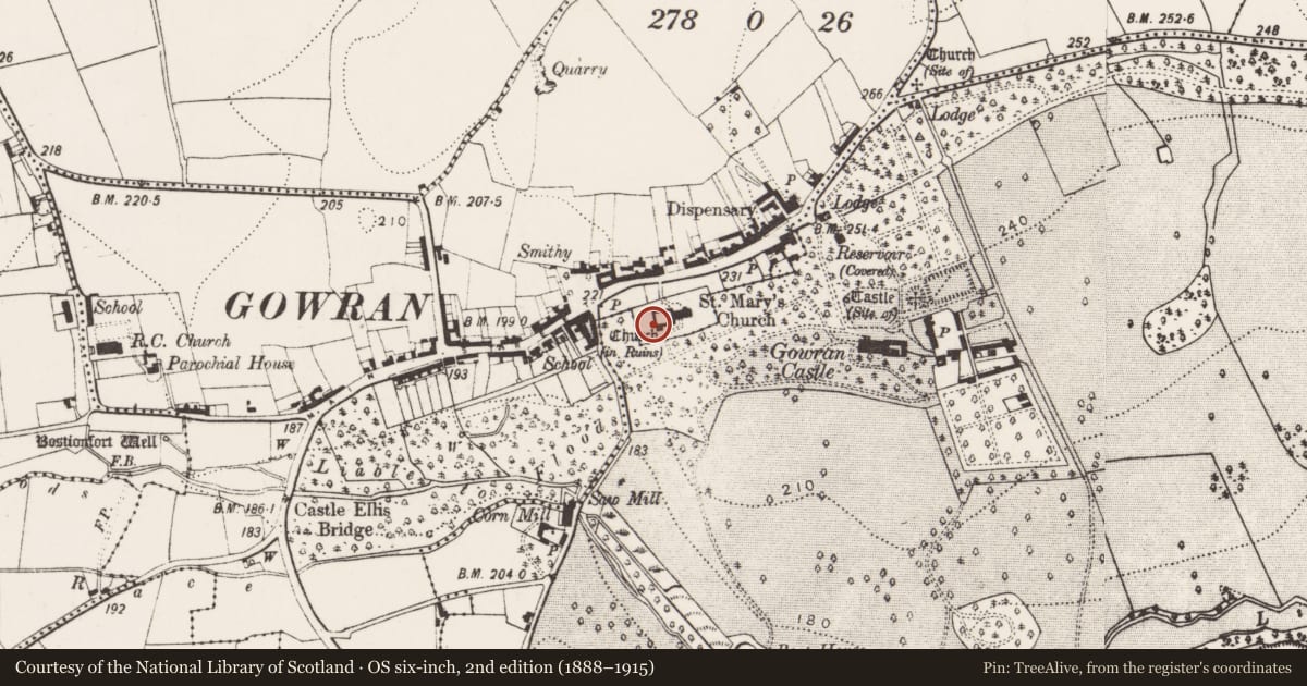
Slide toward Today to fade the historical sheet and see the modern map underneath.
David Rumsey Map Collection, Stanford LibrariesUniversity Library, Vrije Universiteit AmsterdamDavid Rumsey Map Collection, Stanford LibrariesDavid Rumsey Map Collection, Stanford Libraries
4 historical maps cover this location, the earliest the 1790 map "Composite: Ireland." (David Rumsey Map Collection, Stanford Libraries).
Historical maps covering this location
- 1790 · Composite: Ireland. (David Rumsey Map Collection, Stanford Libraries)
- 1869 · Ireland. (David Rumsey Map Collection, Stanford Libraries)
- 1891 · Ireland 16 (David Rumsey Map Collection, Stanford Libraries)
- 1904 · Sheet 14, 1904 (University Library, Vrije Universiteit Amsterdam)
This record in the National Monuments Service's Historic Environment Viewer ↗
The National Monuments Service's description
Lying on shelving within the 17th-century mortuary chapel adjoining externally the S wall of the nave of the 13th-century church of St Mary’s (KK020-060006-) in Gowran. Two pieces, which fit together, of a broken straight-sided limestone graveslab (Tot. surviving H 1.02m; upper portion with cross-head H 0.67m; Wth 0.56m; lower portion with cross-shaft H 0.57m; Wth 0.4m)decorated in raised relief with a seven-armed floriated cross with a two bar-knop at the base of the cross-head. There was a raised border (Wth 0.09m) around the edge, but only a portion of this survives on the sinister side. The broken upper portion bears part of the cross-head and sinister margin and the lower portion the cross-shaft and sinister margin. This may be the slab described by Carrigan (1905, vol. 3, 405) as, ‘A very large floor-slab, or table of altar-tomb, now broken, with an eight-pointed cross down the centre, and dating from about the year 1600, has the following Old English inscription, in relief, down one of the sides: Hic jacet Richard Nase et Ellana Shortall exor ei q obiit [ ] die mensis [ ]. This is the entire of the original inscription. The tomb lies in the nave’.
Compiled by: Jean Farrelly
Date of upload: 18 September 2019
Nearby in the register
- Graveslabunder 1 mi
- Armorial plaqueunder 1 mi
- Tomb - effigialunder 1 mi
- Graveslabunder 1 mi
Other entries of the same register within about three miles of this one, by straight line.