Sites and Monuments Record · Ireland
Graveyard
Stangs, County Kilkenny, Ireland
The record
- Townland
- Stangs
- County
- Kilkenny
- Country
- Ireland
- First-edition OS map
- Not indicated
- Latest-edition OS map
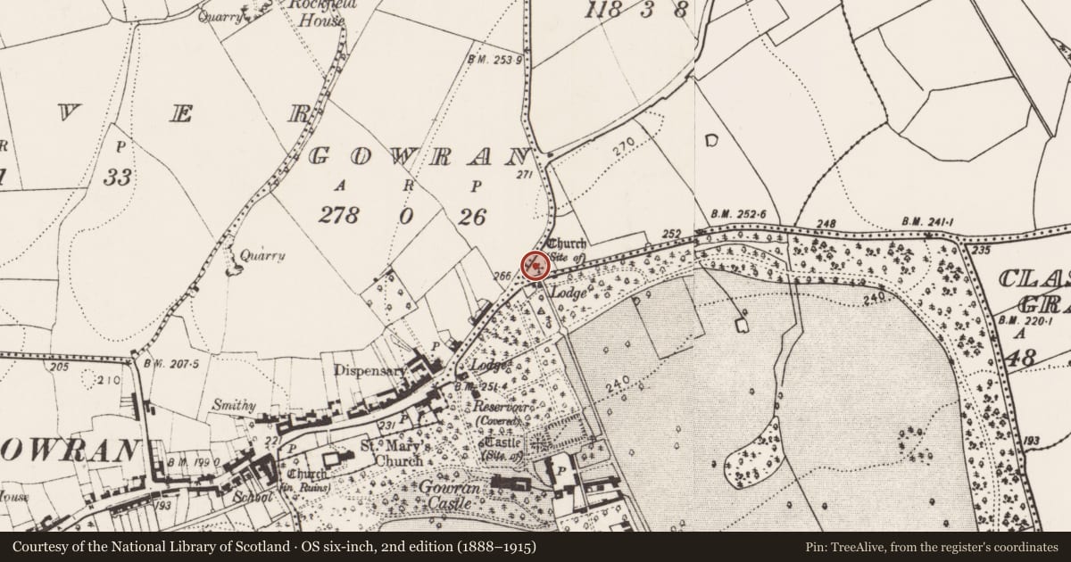
- Church (Site of)
- Coordinates
- 52.63166, -7.06008
- SMR number
- KK020-060013-
Slide toward Today to fade the historical sheet and see the modern map underneath.
David Rumsey Map Collection, Stanford LibrariesUniversity Library, Vrije Universiteit AmsterdamDavid Rumsey Map Collection, Stanford LibrariesDavid Rumsey Map Collection, Stanford Libraries
4 historical maps cover this location, the earliest the 1790 map "Composite: Ireland." (David Rumsey Map Collection, Stanford Libraries).
Historical maps covering this location
- 1790 · Composite: Ireland. (David Rumsey Map Collection, Stanford Libraries)
- 1869 · Ireland. (David Rumsey Map Collection, Stanford Libraries)
- 1891 · Ireland 16 (David Rumsey Map Collection, Stanford Libraries)
- 1904 · Sheet 14, 1904 (University Library, Vrije Universiteit Amsterdam)
This record in the National Monuments Service's Historic Environment Viewer ↗
The National Monuments Service's description
A triangular area (dims. c. 60m NE-SW; max. c. 43m NW-SE at NE end) located c. 50m NE of the former ‘Magdalan Gate’ at the E end of Gowran town and indicated as, ‘Church (Site of)’ on the 1900 revision of the OS 6-inch map. According to Carrigan (1905, vol. 3, 410), the Magdalen or medieval hospital (KK020-060011-) was, ‘just outside the town wall. About 1840 the remains of the chapel [KK020-060012-] attached to this Magdalen were removed and trees planted on the site. The exact spot occupied by the chapel is the angle formed by the public roads to Bagnalstown and Goresbridge, at their point of divergence opposite the pike house’.
During a thunderstorm in the 1960s/70s a number of trees were uprooted revealing skeletons underneath (pers. comm. Mary Moran, 6 July 1992). There are trees and scrub growing in the wider portion of the triangular area which is defined by a stone wall on both roadsides, while the narrower SW portion is under grass and is defined by chains hung between bollards. There are no headstones or grave-markers visible.
Compiled by: Jean Farrelly
Date of upload: 25 March 2021
References
Carrigan, Rev. W. 1905 (Reprint 1981) The history and antiquities of the diocese of Ossory, 4 vols. Kilkenny. Roberts Books and Wellbrook Press.
Nearby in the register
- Hospitalunder 1 mi
- Chapelunder 1 mi
- Maltingsunder 1 mi
- Armorial plaqueunder 1 mi
Other entries of the same register within about three miles of this one, by straight line.