Sites and Monuments Record · Ireland
Fulacht fia
Sraghgaddy, County Kilkenny, Ireland
The record
- Townland
- Sraghgaddy
- County
- Kilkenny
- Country
- Ireland
- First-edition OS map
- Not indciated
- Latest-edition OS map
- Not indciated
- Coordinates
- 52.65686, -7.05747
- SMR number
- KK020-026004-
Slide toward Today to fade the historical sheet and see the modern map underneath.
David Rumsey Map Collection, Stanford LibrariesUniversity Library, Vrije Universiteit AmsterdamDavid Rumsey Map Collection, Stanford LibrariesDavid Rumsey Map Collection, Stanford Libraries
4 historical maps cover this location, the earliest the 1790 map "Composite: Ireland." (David Rumsey Map Collection, Stanford Libraries).
Historical maps covering this location
- 1790 · Composite: Ireland. (David Rumsey Map Collection, Stanford Libraries)
- 1869 · Ireland. (David Rumsey Map Collection, Stanford Libraries)
- 1891 · Ireland 16 (David Rumsey Map Collection, Stanford Libraries)
- 1904 · Sheet 14, 1904 (University Library, Vrije Universiteit Amsterdam)
This record in the National Monuments Service's Historic Environment Viewer ↗
The National Monuments Service's description
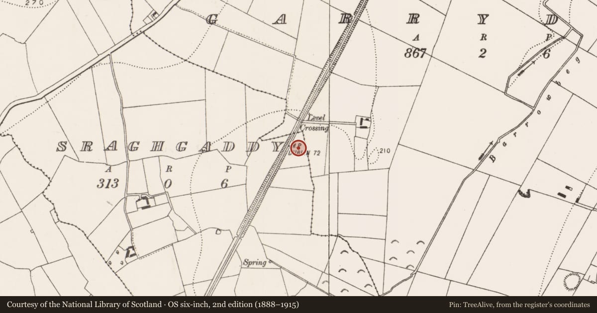
Indicated as an area of marshy terrain on the 1st ed. OS map with a stream running NW-SE through the area. By the 1900 revision a railway line, running NE-SW, has cut through the area. According to O'Kelly (1969, 86), 'Fulachta Fiadh were uncovered here in 1959 near the railway during Land Project drainage operations'. Prendergast (1955, 10) includes in a list of 'Fulacht fiadh sites in Co. Kilkenny ...recorded in 1955...Shraghgaddy townland, Gowran bar. 6" Sheet 20, approx. 22cm from North. 1 cm from East. At least six sites'. These are collected recorded under the SMR number KK020-026---- and each of the individual fulacht fia also assigned a separate SMR number: KK020-026001-; KK020-026002-; KK020-026003-; Kk020-026004-; KK020-026005- and KK020-026006-. These have not been individually located.
Compiled by: Jean Farrelly
Date of upload: 24 November 2020
References
O'Kelly, O. 1969 (Reissue 1985) The place-names of County Kilkenny. Kilkenny.
Prendergast, E. 1955 Pre-historic cooking places in Webbsborough district. Old Kilkenny Review 8, 1-10.
Nearby in the register
- Fulacht fiaunder 1 mi
- Fulacht fiaunder 1 mi
- Fulacht fiaunder 1 mi
- Fulacht fiaunder 1 mi
Other entries of the same register within about three miles of this one, by straight line.