Sites and Monuments Record · Ireland
Enclosure
Leggetsrath East, County Kilkenny, Ireland
The record
- Townland
- Leggetsrath East
- County
- Kilkenny
- Country
- Ireland
- First-edition OS map
- Hachured
- Latest-edition OS map
- Hachured
- Coordinates
- 52.65262, -7.21050
- SMR number
- KK019-030002-
Slide toward Today to fade the historical sheet and see the modern map underneath.
David Rumsey Map Collection, Stanford LibrariesUniversity Library, Vrije Universiteit AmsterdamDavid Rumsey Map Collection, Stanford LibrariesDavid Rumsey Map Collection, Stanford Libraries
4 historical maps cover this location, the earliest the 1790 map "Composite: Ireland." (David Rumsey Map Collection, Stanford Libraries).
Historical maps covering this location
- 1790 · Composite: Ireland. (David Rumsey Map Collection, Stanford Libraries)
- 1869 · Ireland. (David Rumsey Map Collection, Stanford Libraries)
- 1891 · Ireland 16 (David Rumsey Map Collection, Stanford Libraries)
- 1911 · Sheet 14, 1911 (University Library, Vrije Universiteit Amsterdam)
This record in the National Monuments Service's Historic Environment Viewer ↗
The National Monuments Service's description
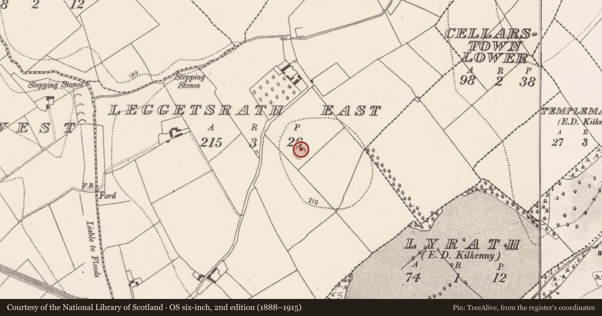
Carrigan (1905, vol. 3, 226-7) describes the church at Leggetsrath East as being, ‘in a field called the “churchfield.” All traces of it have been obliterated; but the circular earthen rampart, about 30 yds. [c. 27m] in diameter, that enclosed it, is still distinctly traceable. In the very centre of the enclosing ring, is an ancient pillar-stone of granite, standing to a height of 3½ ft. [c. 1m] over the ground’. He also mentions that, ‘The next field to the south of the “Church field” is called the “Killeen,” or Little Church, from its proximity to the site of the old church’ (ibid.). According to O’Kelly (1969, 91), ‘the field adjoining [the enclosure] to the east in Cellarstown is called “the Cillín”’. There is no visible trace of a church (KK019-030001-) at ground level, however, the enclosure survives as a roughly oval area (diam. c. 28m N-S; c. 33m E-W) defined by a low earthen bank. It occupies the N portion of a small square field (c. 53m NE-SW and NW-SE) under grass. Further investigations within the enclosure (Prendergast 1964, 5-16) revealed a large ringed cross-head, suggesting that the pillar stone is the shaft of a high cross (KK019-030003-).
Compiled by: Jean Farrelly
Date of upload: 5 October 2020
References
Prendergast, E. 1964 A new high cross at Leggetsrath near Kilkenny. Old Kilkenny Review 16, 5-16.
O'Kelly, O. 1969 (Reissue 1985) The place-names of County Kilkenny. Kilkenny.
Carrigan, Rev. W. 1905 (Reprint 1981) The history and antiquities of the diocese of Ossory, 4 vols. Kilkenny. Roberts Books and Wellbrook Press.
Nearby in the register
- Cross - High crossunder 1 mi
- Churchunder 1 mi
- Fulacht fiaunder 1 mi
- Enclosureunder 1 mi
Other entries of the same register within about three miles of this one, by straight line.