Sites and Monuments Record · Ireland
Graveslab (present location)
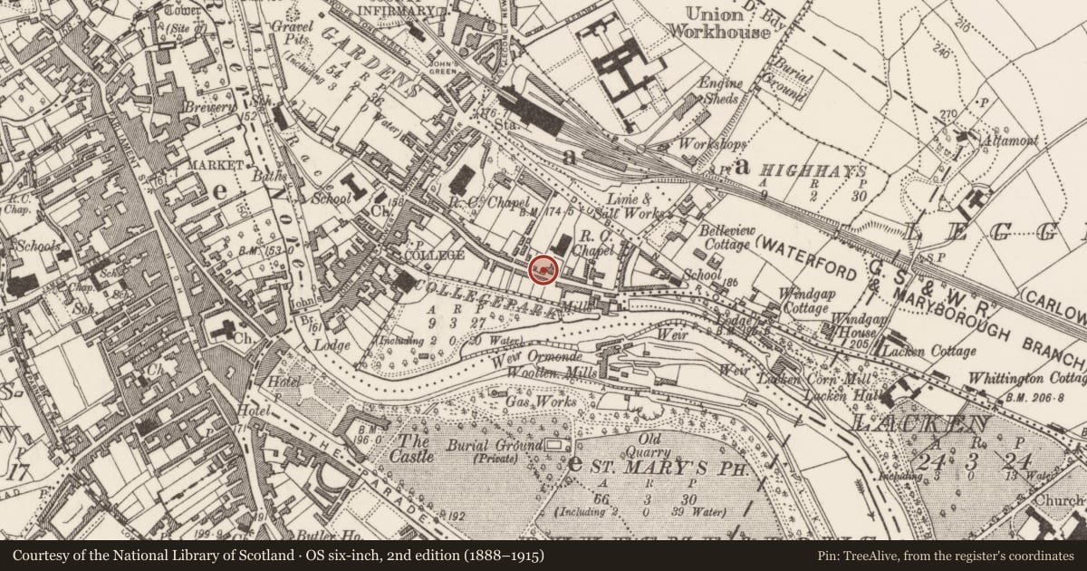
Gardens (Kilkenny City By., St. John's Par.), County Kilkenny, Ireland
The record
- Townland
- Gardens (Kilkenny City By., St. John's Par.)
- County
- Kilkenny
- Country
- Ireland
- First-edition OS map
- Not indicated
- Latest-edition OS map
- Not indicated
- Coordinates
- 52.65264, -7.24472
- SMR number
- KK019-026426-
Slide toward Today to fade the historical sheet and see the modern map underneath.
David Rumsey Map Collection, Stanford LibrariesUniversity Library, Vrije Universiteit AmsterdamDavid Rumsey Map Collection, Stanford LibrariesDavid Rumsey Map Collection, Stanford Libraries
4 historical maps cover this location, the earliest the 1790 map "Composite: Ireland." (David Rumsey Map Collection, Stanford Libraries).
Historical maps covering this location
- 1790 · Composite: Ireland. (David Rumsey Map Collection, Stanford Libraries)
- 1869 · Ireland. (David Rumsey Map Collection, Stanford Libraries)
- 1891 · Ireland 16 (David Rumsey Map Collection, Stanford Libraries)
- 1911 · Sheet 14, 1911 (University Library, Vrije Universiteit Amsterdam)
This record in the National Monuments Service's Historic Environment Viewer ↗
The National Monuments Service's description
Thirteen graveslabs were recovered from the River Nore during the archaeological excavations (01E980) carried out in 2001-2003 as part of the River Nore Drainage Scheme (Doyle and O’Meara 2004, 6-20). These were found associated with the late medieval bridge (KK019-026070-), immediately N of the current John’s Bridge (ibid. 7). It is suggested that the graveslabs were deliberately cleared from a graveyard, possibly belonging to either St Mary’s parish church (KK019-026115-) c. 100m to the W or to St John’s Priory (KK019-026068-) c. 200m to the NE, and used as part of the rubble needed to form a protective apron for the piers of the late medieval bridge (ibid. 16-19). Currently stored in Magdalan tower (KK019-026074-), Maudlin St, Kilkenny.
Fragment of a limestone tapering graveslab (01E0980: 2313) which consists of the central portion of the slab, the head and base of which are missing (ibid. 11, 15). The slab (L 0.7m; Wth 0.45m; T 0.23m), with bevelled edges, is heavily water worn and only the rough outline of the base of the cross-head, formerly in relief, are visible (ibid.). Stylistically this dates to the 13th/14th century (ibid.).
See attached photograph:
KK019-026426-_01 Photograph by Chris Corlett
Compiled by: Jean Farrelly
Date of upload: 16 January 2023
References
Doyle, I.W. and O'Meara, B. 2004 Medieval grave slabs recovered from the River Nore, St John’s Bridge, Kilkenny City. Old Kilkenny Review 56, 6-20.
Nearby in the register
- Graveslab (present location)under 1 mi
- Graveslab (present location)under 1 mi
- Graveslab (present location)under 1 mi
- Graveslab (present location)under 1 mi
Other entries of the same register within about three miles of this one, by straight line.